


![]()
Itinerari TREKKING - Provincia di Savona
TREKKING routes - Savona district
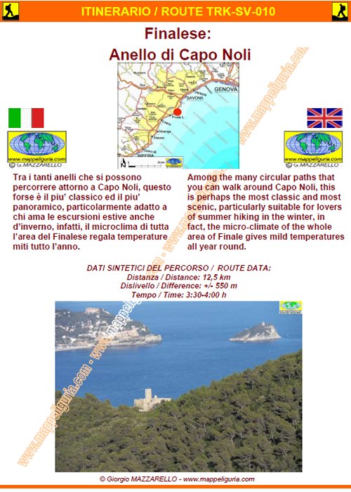
SV-010
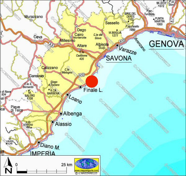
Finalese: Anello di Capo Noli
Finale area: Cape Noli Loop
DATA/DATE
Gennaio 2013
January 2013
NOTE GENERALI / GENERAL NOTES
Tra i tanti anelli che si possono percorrere attorno a Capo Noli, questo forse � il piu� classico ed il piu� panoramico, particolarmente adatto a chi ama le escursioni estive anche d�inverno, infatti, il microclima di tutta l�area del Finalese regala temperature miti tutto l�anno.
From the exit of Spotorno, of the A12 motorway, we reach Spotorno and turn right to Finale Ligure. Just before leaving the village we turn off right towards the plateau of Manie. Shortly after the village of Voze we deviate left uphill and soon we reach the plateau and the restaurant Ferrin. About 250m after the restaurant there is a large dirt clearing to the left where we leave the car.
DATI SINTETICI DEL PERCORSO / ROUTE DATA
Distanza / Distance: 12,5 km
Dislivello / Difference: +/-550 m
Tempo / Time: 3:30-4:00 h
LOCALITA' DI PARTENZA / STARTING PLACE
Il percorso inizia dall�Altopiano delle Manie, in prossimita' del Ristorante Ferrin (Camping Terre Rosse).
The route starts from the plateau of Manie, close to Ristorante Ferrin (Camping Terre Rosse)
COME ARRIVARE / HOW TO REACH STARTING PLACE
![]() Dall�uscita del casello di Spotorno dell'autostrada A12, raggiungiamo Spotorno
e prendiamo a destra per Finale Ligure. Appena prima di uscire dal paese
deviamo a destra in direzione dell�Altopiano delle Manie. Poco dopo
l�abitato di Voze deviamo a sinistra in salita ed in breve raggiungiamo
l�Altopiano ed il ristorante Ferrin. Circa 250m dopo il ristorante c'e'
un grosso spiazzo sterrato a sinistra dove lasciamo l�auto.
Dall�uscita del casello di Spotorno dell'autostrada A12, raggiungiamo Spotorno
e prendiamo a destra per Finale Ligure. Appena prima di uscire dal paese
deviamo a destra in direzione dell�Altopiano delle Manie. Poco dopo
l�abitato di Voze deviamo a sinistra in salita ed in breve raggiungiamo
l�Altopiano ed il ristorante Ferrin. Circa 250m dopo il ristorante c'e'
un grosso spiazzo sterrato a sinistra dove lasciamo l�auto.
From the exit of Spotorno, of the A12 motorway, we reach Spotorno and turn right to Finale Ligure. Just before leaving the village we turn off right towards the plateau of Manie. Shortly after the village of Voze we deviate left uphill and soon we reach the plateau and the restaurant Ferrin. About 250m after the restaurant there is a large dirt clearing to the left where we leave the car.
PERIODO / WHEN TO GO
Tutto l�anno.
This route is open year-round.
DIFFICOLTA' / DIFFICULTIES
Secondo la scala CAI: E (Escursionistica).
Il percorso si svolge su strade asfaltate, strade sterrate
e su facili sentieri sempre ben segnalati.
According to the scale CAI: E (Escursionistica)
The whole route runs on paved roads, dirt roads and easy paths, always well marked.
SCHEDA PERCORSO / ROAD-BOOK
LIBRETTO DI 14 PAGINE CON TUTTI I DATI PER EFFETTUARE L'ITINERARIO
BOOKLET OF 14 PAGES WITH INSIDE ALL INFOMATIONS TO MAKE THE ROUTE
CARTE DI DETTAGLIO / DETAILED MAPS
Tutto il percorso descritto e' contenuto nelle seguenti tavole della collana
mini MAPPE OUTDOOR ACTIVITIES
This route is showed on following
mini MAPPE OUTDOOR ACTIVITIES type maps
Per raggiungere la localita' di partenza e' utile utilizzare la seguente tavola della
collana mini MAPPE CAR
To reach starting places is useful following
mini MAPPE CAR type map
Sei interessato alle CARTE DI DETTAGLIO di questo percorso?
CONTATTAMI
Are you interested about DETAILED MAPS of this route?
WRITE ME
QUALCHE FOTO / SOME PICTURES
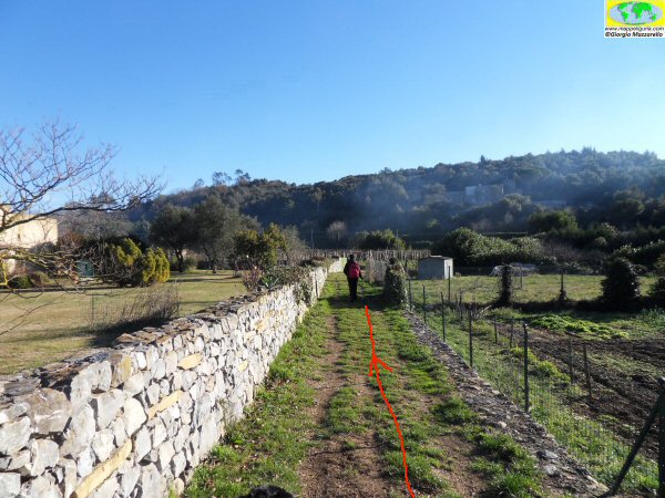
Lungo il sentiero tra le villette di Isasco
Along the path between the houses of Isasco
La strada cementata che scende verso il Rio Armoreo
The concrete road leading down to the Rio Armoreo
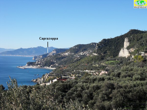
Panorama verso ponente con la bianca falesia di Kien sulla destra
Panorama to the west with on right the white cliffs of Kien
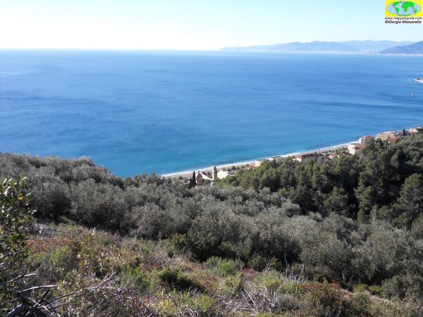
Panorama sulla costa occidentale di Varigotti
Panorama on the west coast of Varigotti
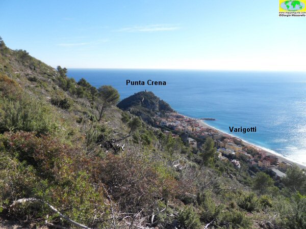
Panorama su Varigotti e sulla Punta Crena
Panorama of Varigotti and Punta Crena
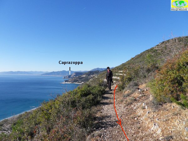
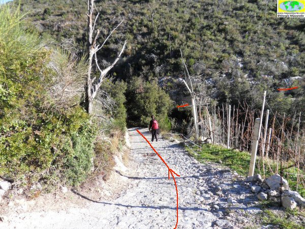
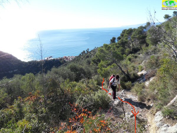
Lungo il sentiero che corre alto sopra Varigotti
Along the path that runs high above Varigotti
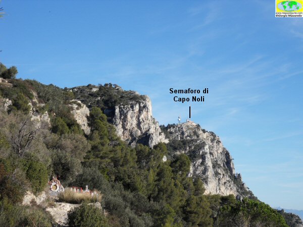
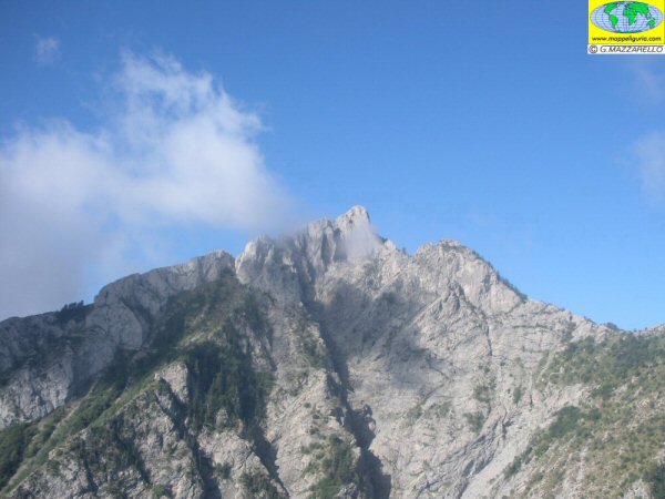
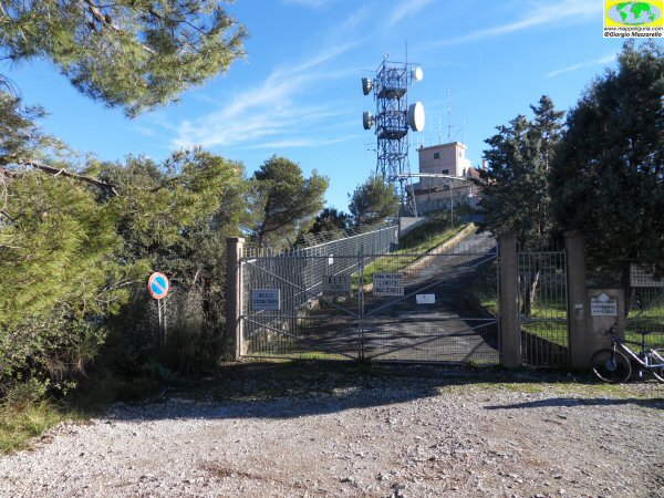
La vetta del Semaforo di Capo Noli
The summit of Capo Noli lighthouse
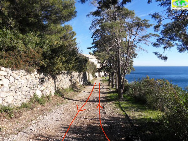
La strada che raggiunge la panoramica chiesa di S.Lorenzo
The road reaches the panoramic church of San Lorenzo
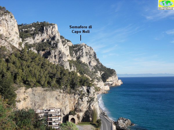
Panorama verso levante con la vetta del Semaforo di Capo Noli
View towards the east with the top of the lighthouse of Capo Noli
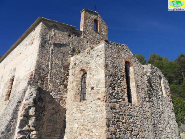
L'antica chiesa di S.Lorenzo
The ancient church of San Lorenzo
Nei pressi del muretto con i bassorilievi marinari
Near the wall with bas-reliefs in a nautical theme
Salendo verso il Semaforo
Going up to the lighthouse
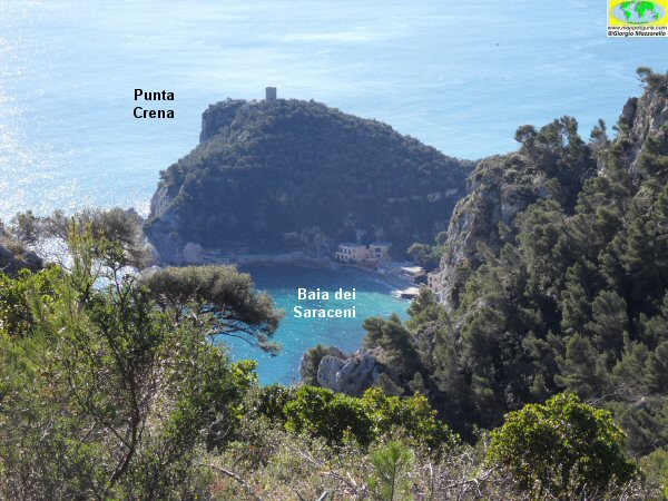
Panorama sulla Punta Crena e sulla Baia dei Saraceni
Panorama on Punta Crena and Saracen Bay
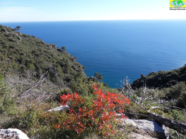
Scorci di Mediterraneo
Glimpses of the Mediterranean
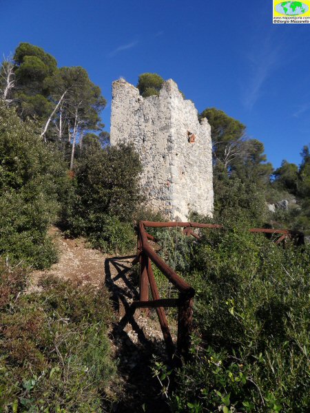
La Torre delle Streghe
The Tower of the Witches
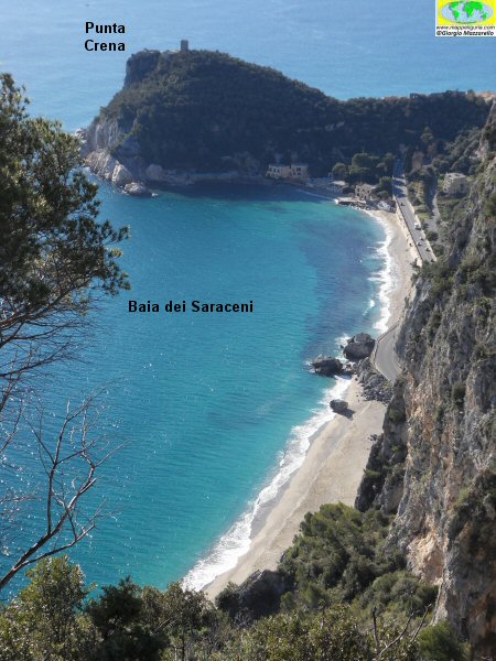
Panorama sulla Punta Crena e sulla Baia dei Saraceni
Panorama on Punta Crena and Saracen Bay
Nei pressi del piazzale del Semaforo di Capo Noli
Near the square of the lighthouse of Capo Noli
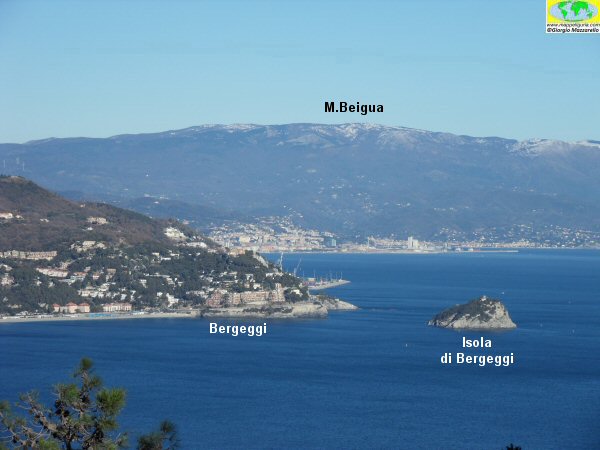
Panorama su Bergeggi
Panorama of Bergeggi
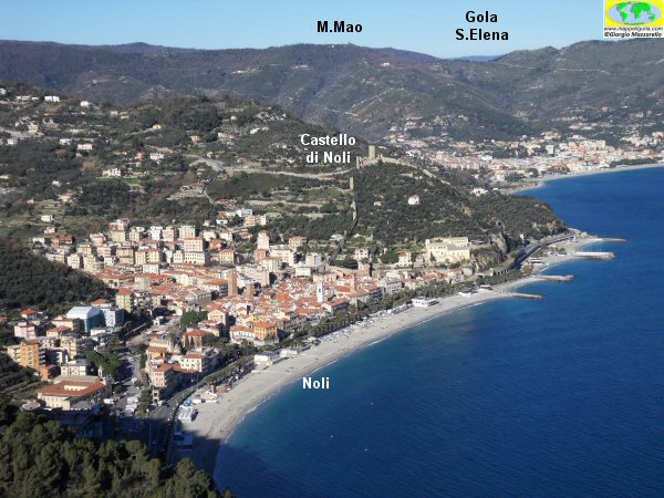
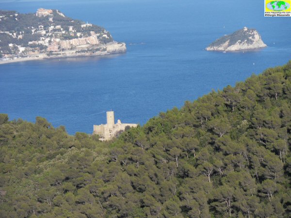
Noli con la sua baia ed il suo castello
The village of Noli with its beach and its castle
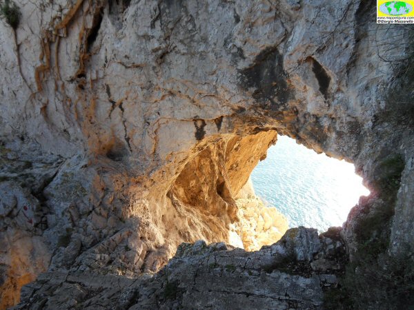
L'accesso alla Grotta dei Falsari
Access to the Cave Grotta dei Falsari
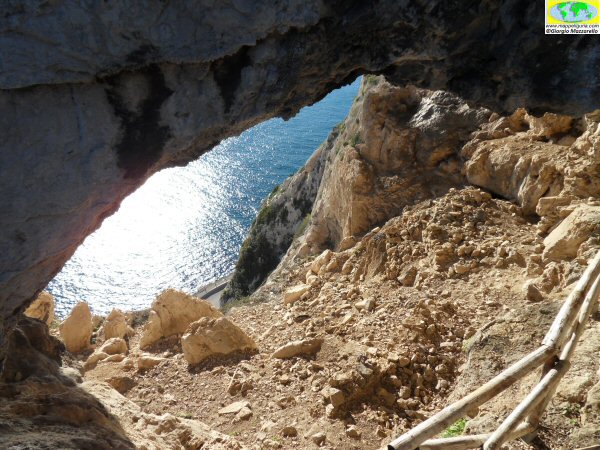
Mare e Grotta
Sea and Cave
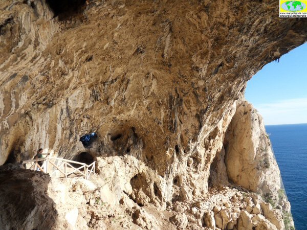
L'interno dell'ampio antro chiamato Grotta dei Falsari
Inside the whide Cave Grotta dei Falsari
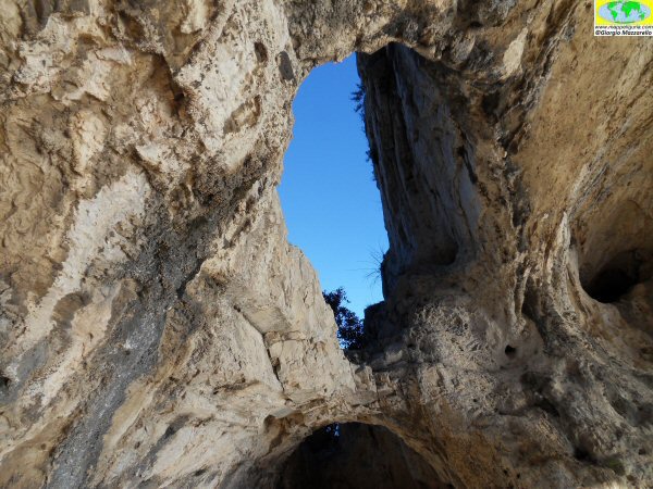
Cielo e Grotta
Sky and Cave
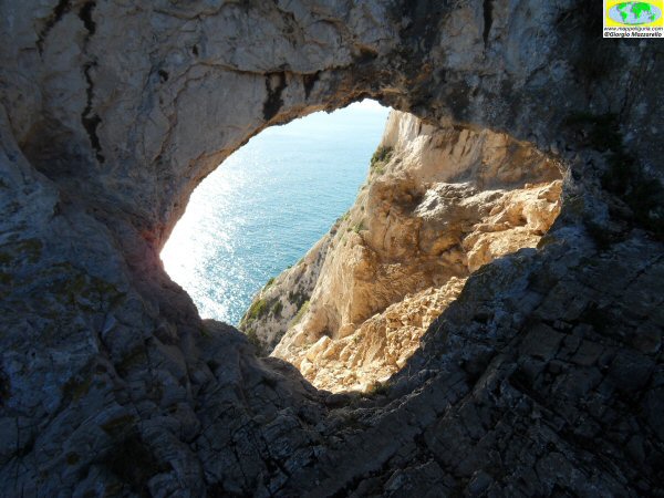
Mare e Grotta
Sky and Cave
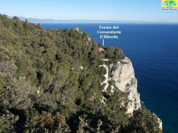
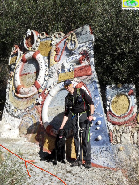
Panorama verso levante con ben visibile il poggio dove e' situato l'Eremo del Comandante D'Albertis
View towards the east, with the hill where is located the Hermitage of Commander D'Albertis
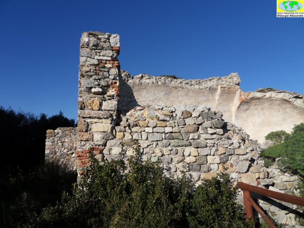
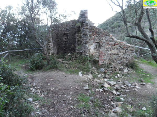
I ruderi della Chiesa di S.Margherita
The ruins of the Church of Santa Margherita
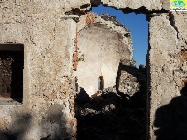
I ruderi della Chiesa di S.Margherita
The ruins of the Church of Santa Margherita
Panorama su Noli
View of Noli
Ruderi della piccola chiesa di S.Lazzaro
The ruins of the small Church of S.Lazzaro
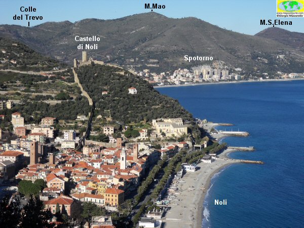
Panorama sulla baia di Noli
Overview of the Bay of Noli
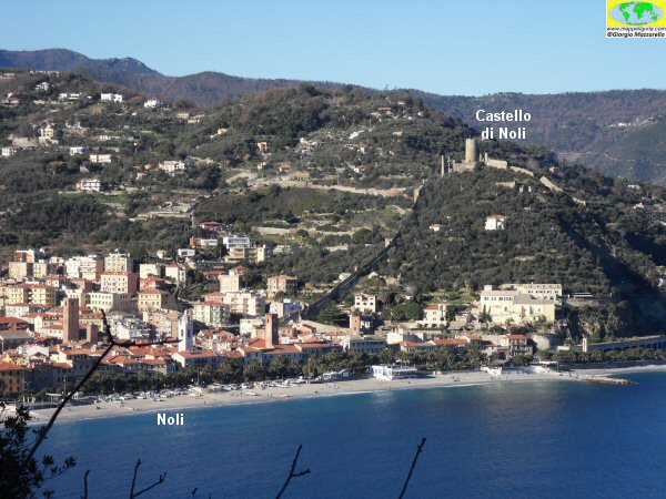
Castello di Noli e Isola di Bergeggi
Castle of Noli and Bergeggi Island
NOTE /NOTICE
Pur avendo prestato la massima attenzione nella stesura della descrizione del percorso, a causa della mutevolezza del territorio, della variabilita' delle condizioni meteo e di eventuali errori od imprecisioni o giudizi soggettivi indicati nel presente testo, l'autore declina ogni responsabilita' per eventuali incidenti che potrebbero verificarsi. Chi desidera effettuare questo percorso lo fa a proprio rischio e pericolo.
In the description of the route I have done the greatest care, but because of the changing nature of the area, the variability of weather conditions and any errors or inaccuracies or subjective judgments referred to in this text, the author disclaims all responsibility for any accidents that may occur. Those wishing to go this route you do so at your own risk.
Chiunque desiderasse avere maggiori informazioni su questo itinerario, mi
puo' contattare.
Do you want more information about this route?
Please write me
