

![]()
Itinerari TREKKING - Liguria
TREKKING routes - Liguria
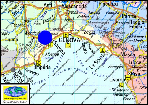
Liguria-005
Itinerari Bormida Natura
Bormida Natura Routes
DATA/DATE
2017
NOTE GENERALI / GENERAL NOTES
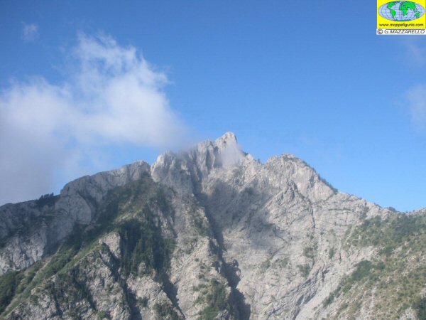
Sotto i fitti boschi della Valle Bormida e' nascosto un vero e pradiso per gli escursionisti. Si tratta dei percorsi denominati "Bormida Natura" che, assieme agli altri sentieri esistenti costituiscono una rete sentieristica tutta segnalata e agibile, che permette di effettuare infiniti itinerari per scoprire il polmone verde della provincia di Savona. In linea di massima questi percorsi sono costituiti da un grande anello principale di circa 90 km che, percorrendo i due crinali, contorna tutta la valle. Dal percorso principale si staccano diversi itinerari secondari che raggiungono o le principali vette o scendono ai borghi del fondovalle. Complessivamente la rete Bormida Natura e' lunga circa 130 km.
Under the thick forests of the Bormida Valley it is hidden a real Paradis for the hikers. These are the paths named "Bormida Nature" which, together with other existing footpaths are a network of trails, all signposted and practicable, which allows to make endless routes to discover the green heart of the province of Savona. In general these paths are constituted by a large main ring of about 90 km which, crossing the two ridges, surrounds the entire valley. From the main trail start several secondary routes that reach or the main peaks or descend to the valley towns. Overall, the Bormida Natura network is about 130 km long.
DATI SINTETICI DEL PERCORSO / ROUTE DATA
Distanza totale / Total Distance: 130 km circa/abt.
Tempo / Time: 5-8 giorni/days
DIFFICOLTA' / DIFFICULTIES
Secondo la scala CAI: compreso tra T ed E (a seconda dei tratti).
Si tratta di un percorso relativamente facile che transita su strade asfaltate a basso traffico, srade sterrate, mulattiere e comodi sentieri.
According to CAI scale: between T and E (depending on the section).
It is an easy route that passes on low traffic road, dirt roads, mule trails and easy trails.
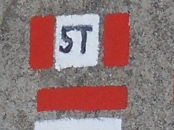
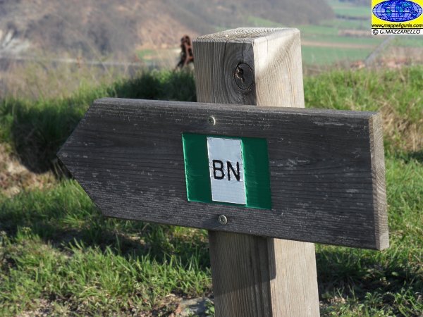
IL SEGNAVIA CHE SI INCONTRA / TRAIL-SIGN

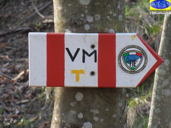
Il segnavia dei percorsi "Bormida Natura" e' costituito da una bandierina verde-bianco-verde con la scritta "BN".
The trail-sign of "Bormida Nature" routes consists of a green-white-green flag with the inscription "BN".
ATTENZIONE / WARNING
ATTENZIONE: questo percorso non � sempre sottoposto a costante e periodica manutenzione con ripristino dei segnavia deteriorari e pulizia dei sentieri.
Tale situazione potrebbe rendere questo tracciato non sempre evidente e facile da seguire.
Per questo motivo RACCOMANDO VIVAMENTE DI EFFETTUARE L'ITINERARIO MUNITI DI IDONEA CARTOGRAFIA E/O DI DESCRIZIONE DETTAGLIATA DEL PERCORSO.
WARNING: this path is not always subjected to constant and periodic maintenance with remaking of the damaged trail markers and cleaning of the pedestrian paths.
This situation could make this path not always evident and easy to follow.
For this reason I STRONGLY RECOMMEND YOU TO CARRY OUT THE ITINERARY WITH SUITABLE CARTOGRAPHY AND / OR DETAILED DESCRIPTION OF THE ROUTE.
IL PERCORSO IN SINTESI / ROUTE SUMMARY
![]() Le principali localita' toccate dall'anello principale dei sentieri "Bormida Natura" sono le seguenti:
Le principali localita' toccate dall'anello principale dei sentieri "Bormida Natura" sono le seguenti:
![]() Here below a brief summary of the various places crossed by main loop of "Bormida Natura" routes:
Here below a brief summary of the various places crossed by main loop of "Bormida Natura" routes:
- Piana Crixia.......
- ...................
- ...................
- ...................
- ...................
- ...................
- ...................
- ...................
- ...................
- ...................
- ...................
- ...................
- Piana Crixia.......
![]() Le localit� toccate dal percorso e i punti dove trovare ristoro/alloggio sono presenti nelle tavole delle mini MAPPE OUTDOOR ACTIVITIES.
Le localit� toccate dal percorso e i punti dove trovare ristoro/alloggio sono presenti nelle tavole delle mini MAPPE OUTDOOR ACTIVITIES.
![]() Places crossed by route and accommodation points are indicated on Hiking Maps of route "mini MAPPE OUTDOOR ACTIVITIES" type.
Places crossed by route and accommodation points are indicated on Hiking Maps of route "mini MAPPE OUTDOOR ACTIVITIES" type.
![]() The hiker can split the path at his pleasure, stopping to spend the night
in different locations where there are the accommodations.
The hiker can split the path at his pleasure, stopping to spend the night
in different locations where there are the accommodations.
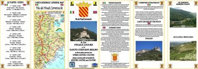
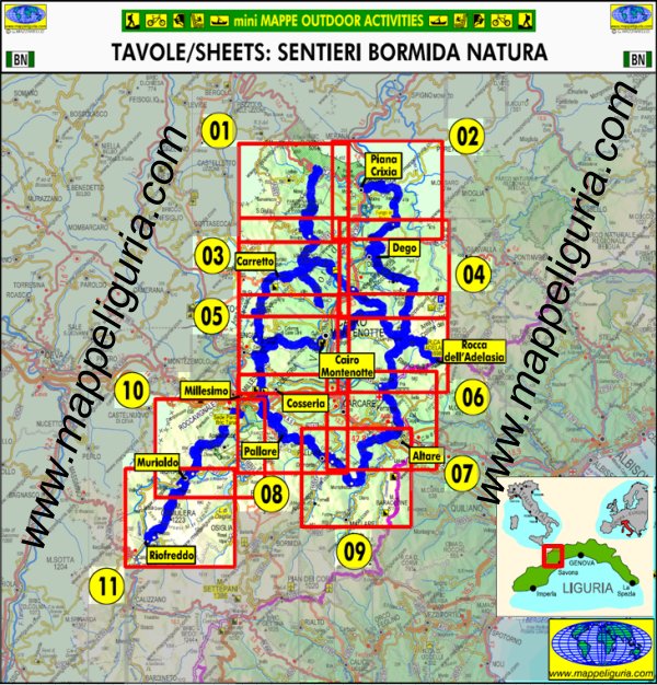
LE CARTE DEL PERCORSO / ROUTE MAPS
![]()
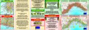
Per questo lungo itinerario ho realizzato la cartografia di dettaglio di tutto il percorso.
Si tratta di una serie di carte di tipo Escursionistico, appartenenti alla mia collana
mini MAPPE OUTDOOR ACTIVITIES, in scala 1:25.000 costituite da 12 tavole formato A3.
Su ogni tavola, oltre ai vari sentieri escursionistici, sono presenti indicazioni su:
- I percorsi "Bormida Natura"
- I vari luoghi che si incontrano lungo l'itinerario
- Dove e' possibile fermarsi per mangiare e per dormire
TRACCIA GPS
Oltre alla Carte Escursionistiche ho anche realizzato la traccia GPS di tutto il percorso, che e' disponibile su specifica richiesta.
For this long journey I made the detailed maps of the entire route.
They are Hiking Maps type mini MAPPE OUTDOOR ACTIVITIES in scale 1:25.000, and they consist of 12 Map-Sheets size A3.
On each Map-Sheet, together with the other existing hiking trails, there are indications of:
- "Bormida Natura" routes
- Places along the route
- Where you can stop to eat and to sleep
GPS TRACK
In addition to detailed maps, I also created the GPS track of the full path, which is available on request.
QUADRO DI UNIONE DELLE VARIE CARTE DI DETTAGLIO DEL PERCORSO
Anteprima delle carte selezionando i riquadri delle varie tavole
GENERAL VIEW OF MAP-SHEETS OF ROUTE
Preview of Maps by selecting red box
Sei interessato a queste carte? CONTATTAMI
Are you interested in this group of maps? WRITE ME
