

![]()
Itinerari TREKKING - Provincia di Savona e di Cuneo
TREKKING routes - Savona and Cuneo district
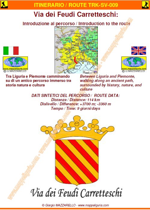
SV-CN-009 - La "Via dei Feudi Carretteschi"
camminando su di un antico percorso immerso tra storia natura e cultura
walking along an ancient path, surrounded by nature, history and culture
![]()
Testi e foto di queste pagine sono di F.Ferrari e G.Mazzarello
Text and photos on these pages of F.Ferrari and G.Mazzarello
DATA/DATE
2007-2011
ATTENZIONE / WARNING
ATTENZIONE: questo percorso non � sempre sottoposto a costante e periodica manutenzione con ripristino dei segnavia deteriorari e pulizia dei sentieri.
Tale situazione potrebbe rendere questo tracciato non sempre evidente e facile da seguire.
Per questo motivo RACCOMANDO VIVAMENTE DI EFFETTUARE L'ITINERARIO MUNITI DI IDONEA CARTOGRAFIA E/O DI DESCRIZIONE DETTAGLIATA DEL PERCORSO.
WARNING: this path is not always subjected to constant and periodic maintenance with remaking of the damaged trail markers and cleaning of the pedestrian paths.
This situation could make this path not always evident and easy to follow.
For this reason I STRONGLY RECOMMEND YOU TO CARRY OUT THE ITINERARY WITH SUITABLE CARTOGRAPHY AND / OR DETAILED DESCRIPTION OF THE ROUTE.
ARTICOLI APPARSI SUGLI ORGANI DI INFORMAZIONE / ARTICLES PUBLISHED ON NEWSPAPERS
ANTEPRIMA NOTE GENERALI / GENERAL NOTES PREVIEW
Consulta il testo selezionando i vari argomenti
View the text by selecting various topics
INTRODUZIONE / INTRODUCTION
CENNI STORICI / BRIEF HISTORY
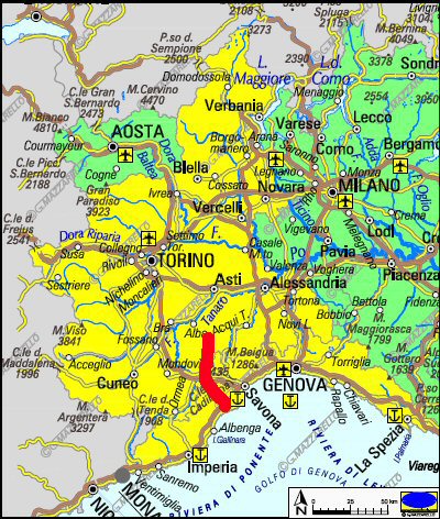
I TERRITORI ATTRAVERSATI DALL'ITINERARIO / LANDS CROSSED BY THE ROUTE
Il Finalese / Finalese
L'Alta Val Bormida / High Bormida Valley
La Langa / Langa
IL PERCORSO IN BREVE / THE TOUTE IN FEW WORDS
![]()
La "Via dei Feudi Carretteschi" e' stata ideata e realizzata sul territorio dal caro amico
Franco FERRARI
(CAI ULE)
con la collaborazione delle Sezioni CAI di Finale Ligure, Altare e Cengio (Sottosezione di Savona)
nonche' degli enti locali presenti lungo il tracciato.
The "Via dei Feudi Carretteschi" was designed and built on the territory by my dear friend
Franco FERRARI
(CAI ULE)
with the collaboration of CAI Sections of Finale Ligure, Altare and Cengio (Subsection of Savona)
as well as local authorities present along the path.
![]()
L'inaugurazione del percorso e' avvenuta il 16 giugno 2007.
The opening of the route took place June 16, 2007.
LIBRETTO DI INTRODUZIONE AL PERCORSO / BOOKLET OF INTRODUCTION TO THE ROUTE
16 PAGINE FORMATO A5
16 PAGES SIZE A5
IL PERCORSO / THE PATH
DATI SINTETICI DEL PERCORSO / ROUTE DATA
Distanza / Distance: 114 km
Dislivello / Difference: +3700/-3360 m circa
Tempo / Time: 9 giorni/days
DIFFICOLTA' / DIFFICULTIES
Secondo la scala CAI: compreso tra T ed EE (a seconda delle tappe).
Si tratta di un percorso facile che transita su sterrate, mulattiere e comodi sentieri.
According to CAI scale: between T and EE (depending on the step).
It is an easy route that passes on dirt roads, mule trails and easy trails.
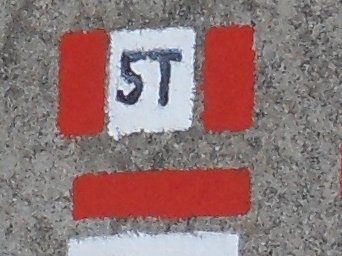
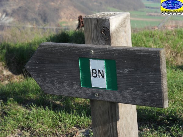
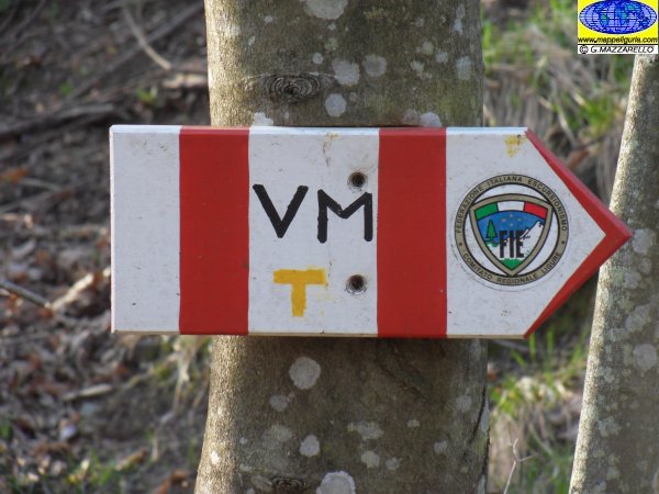
IL SEGNAVIA CHE SI INCONTRA / TRAIL-SIGN
![]()
Questo e' il segnavia presente lungo il percorso / This in the trail-sign along the route
LE VARIE TAPPE IN DETTAGLIO / ALL STEPS IN DETAIL
Consulta il dettaglio selezionando le varie tappe / Select the step to see detail data
- Tappa/Step 1 - Finalborgo (Finale L.) - Pian Soprano (Bormida)
- Tappa/Step 2 - Pian Soprano (Bormida) - Millesimo o Cosseria
- Tappa/Step 3 - Millesimo o Cosseria - Saliceto
- Tappa/Step 4 - Saliceto - Gottasecca
- Tappa/Step 5 - Gottasecca - Prunetto
- Tappa/Step 6 - Prunetto - Bergolo
- Tappa/Step 7 - Bergolo - Cortemilia
- Tappa/Step 8 - Cortemilia - Castino
- Tappa/Step 9 - Castino - S.Stefano Belbo
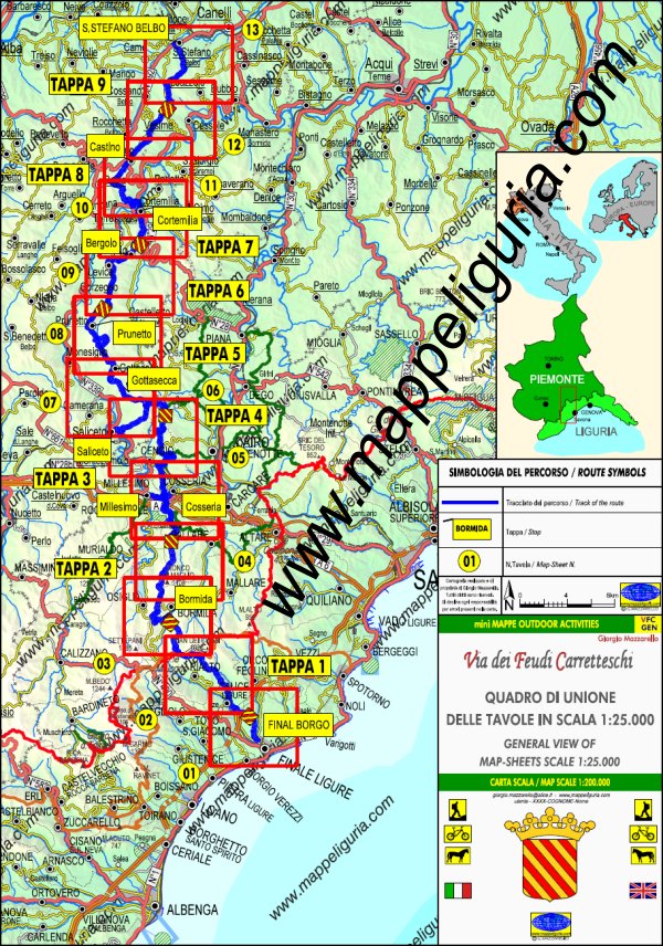
LE CARTE DEL PERCORSO / ROUTE MAPS
Per questo lungo itinerario ho realizzato la cartografia di dettaglio di tutto il percorso.
Si tratta di una serie di carte di tipo Escursionistico, appartenenti alla mia collana
mini MAPPE OUTDOOR ACTIVITIES, in scala 1:25.000 costituite da 13 tavole formato A3.
Su ogni tavola, oltre ai vari sentieri escursionistici, sono presenti indicazioni su:
- Il percorso della Via dei Feudi Carretteschi
- I vari luoghi che si incontrano lungo l'itinerario
- Dove e' possibile fermarsi per mangiare e per dormire
For this long journey I made the detailed maps of the entire route.
They are Hiking Maps type mini MAPPE OUTDOOR ACTIVITIES in scale 1:25.000, and they consist of 13 Map-Sheets size A3.
On each Map-Sheet, as well as various hiking trails, there are indications of:
- All Via dei Feudi Carretteschi path
- Places along the route
- Where you can stop to eat and to sleep
QUADRO DI UNIONE DELLE VARIE CARTE DI DETTAGLIO DEL PERCORSO
Anteprima delle carte selezionando i riquadri delle varie tavole
GENERAL VIEW OF MAP-SHEETS OF ROUTE
Preview of Maps by selecting red box
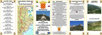
PIEGHEVOLE DI PRESENTAZIONE DEL PERCORSO / BROCHURE TO INTRODUCE THE ROUTE
Scaricabile / For download
Una versione cicloturistica della VIA DEI FEUDI CARRETTESCHI
L'amico
DIRIENZI Renzo
ha individuato anche una versione cicloturistica della "Via dei Feudi Carretteschi" da percorrere con la bici da strada.
Si tratta di una alternativa che transita totalmente su strade asfaltate a basso traffico e che, pur non toccando tutte le localita'
del percorso pedonale, ne raggiunge le tappe significative e attraversa sostanzialmente quasi tutti gli ambienti naturali e storico-culturali
dell'itinerario pedonale.
Maggiori informazioni su questo tracciato alternativo sono consultalili alla pagina che DIRIENZI ha dedicato al percorso:
"VERSIONE CICLOTURISTICA DELLA VIA DEI FEUDI CARRETTESCHI"
A version for bike of VIA DEI FEUDI CARRETTESCHI
My friend
DIRIENZI Renzo
has also identified a cycling version of the "Via dei Carretteschi Feuds" to travel by the road bike.
It is an alternative, which passes entirely on paved roads with little traffic.
This route not pass through all the locations of the pedestrian path, but it reaches all the milestones and crosses substantially
almost all natural and cultural-historical environments of pedestrian route.
More informations on web-page of DIRIENZI :
"VERSIONE CICLOTURISTICA DELLA VIA DEI FEUDI CARRETTESCHI"
NOTE /NOTICE
Pur avendo prestato la massima attenzione nella stesura della descrizione del percorso presente nelle SCHEDE PERCORSO, a causa della mutevolezza del territorio, della variabilita' delle condizioni meteo e di eventuali errori od imprecisioni o giudizi soggettivi indicati nel presente testo, l'autore declina ogni responsabilita' per eventuali incidenti che potrebbero verificarsi. Chi desidera effettuare questo percorso lo fa a proprio rischio e pericolo.
In the description of the route inside ROAD-BOOK (SCHEDE PERCORSO)I have done the greatest care, but because of the changing nature of the area, the variability of weather conditions and any errors or inaccuracies or subjective judgments referred to in this text, the author disclaims all responsibility for any accidents that may occur. Those wishing to go this route you do so at your own risk.
Chiunque desiderasse avere maggiori informazioni su questo itinerario, mi
puo' contattare.
Do you want more information about this route?
Please write me
