
![]()
Itinerari TREKKING - Provincia di Savona
TREKKING routes - Savona district
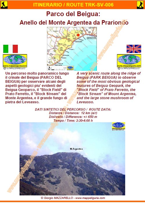
TRK-SV-006- Parco del Beigua: Anello del Monte Argentea da Prariondo
DATA/DATE
Ottobre 2007
October 2007
NOTE GENERALI / GENERAL NOTES
Un percorso molto panoramico lungo il crinale del Beigua (PARCO DEL BEIGUA). per osservare alcuni degli aspetti geologici piu� evidenti del Beigua Geoparco, il "Block Field" di Prato Ferretto, il "Block Stream" del Monte Argentea, e il grande fungo di pietra del Leveasso.
A very scenic route along the ridge of Beigua (PARCO DEL BEIGUA) to observe some of the most obvious geological features of Beigua Geopark, the "Block Field" of Prato Ferretto, the "Block Stream" of Mount Argentea, and the large stone mushroom of Leveasso.
DATI SINTETICI DEL PERCORSO / ROUTE DATA
Distanza / Distance: 12 km
Dislivello / Difference: +/-650 m
Tempo / Time: 3:30-4:00 h
LOCALITA' DI PARTENZA / STARTING PLACE
Il percorso inizia dal rifugio Prariondo, poco ad est della vetta del Beigua (SV)
The route starts from the shelter Prariondo, just east of the summit of Beigua (SV)
COME ARRIVARE / HOW TO REACH STARTING PLACE
![]() Dall�uscita di Varazze dell�autostrada A10, prendiamo a destra e raggiungiamo
Varazze dove deviamo a destra per Stella e Sassello. Presso il borgo de
Il Pero prendiamo ancora a destra per Alpicella e per il Monte Beigua.
Raggiunta la vetta del Monte Beigua (antenne), procediamo oltre verso est
e scendiamo al pianoro dove e� situato il Rifugio Prariondo (posteggio)
Dall�uscita di Varazze dell�autostrada A10, prendiamo a destra e raggiungiamo
Varazze dove deviamo a destra per Stella e Sassello. Presso il borgo de
Il Pero prendiamo ancora a destra per Alpicella e per il Monte Beigua.
Raggiunta la vetta del Monte Beigua (antenne), procediamo oltre verso est
e scendiamo al pianoro dove e� situato il Rifugio Prariondo (posteggio)
From the exit of Varazze, of the A10 motorway, we turn right and reach Varazze where we deviate to the right to Stella and Sassello. At the village of Il Pero we take right again to Alpicella and Monte Beigua. After reaching the top of Mount Beigua (antennas), we proceed over to the east and go down to the plateau where is located the Shelter Prariondo (parking)
PERIODO / WHEN TO GO
Tutto l�anno.
This route is open year-round.
DIFFICOLTA' / DIFFICULTIES
Secondo la scala CAI: E (Escursionistica).
Il percorso si svolge su strade sterrate, su sentieri segnalati e non.
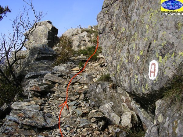
Presso la vetta del Monte Argentea si deve percorrere un breve tratto su grossi massi e rocce.
![]()
According to CAI classification: E (for Normal Hiker).
The whole route runs on paved roads, dirt roads and foot-paths, partially marked.
At the summit of Mount Argentea we must walk a short distance on large boulders and rocks.
SCHEDA PERCORSO / ROAD-BOOK
LIBRETTO DI 10 PAGINE CON TUTTI I DATI PER EFFETTUARE L'ITINERARIO
BOOKLET OF 10 PAGES WITH INSIDE ALL INFOMATIONS TO MAKE THE ROUTE
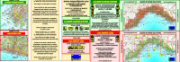
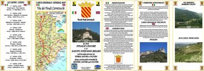
CARTE DI DETTAGLIO / DETAILED MAPS
Tutto il percorso descritto e' contenuto nelle seguenti tavole della collana
mini MAPPE OUTDOOR ACTIVITIES
This route is showed on following
mini MAPPE OUTDOOR ACTIVITIES type maps
Per raggiungere la localita' di partenza e' utile utilizzare la seguente tavola della
collana mini MAPPE CAR
To reach starting places is useful following
mini MAPPE CAR type map
Sei interessato alle CARTE DI DETTAGLIO di questo percorso?
CONTATTAMI
Are you interested about DETAILED MAPS of this route?
WRITE ME
QUALCHE FOTO / SOME PICTURES
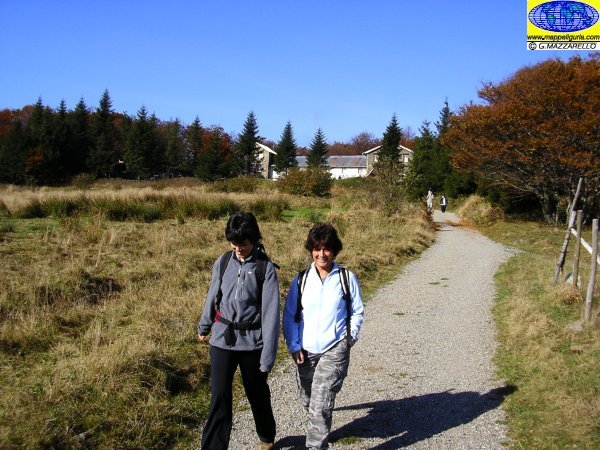
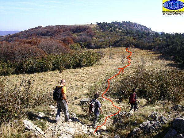
Lungo l'ampia strada sterrata poco dopo il Rifugio Prariondo
Along the wide dirt road shortly after the Shelter Prariondo
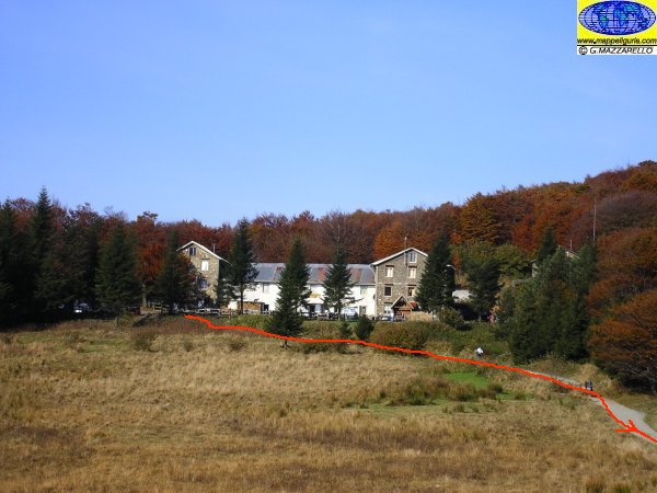
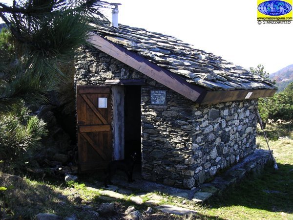
Il Rifugio Prariondo
Prariondo Shelter
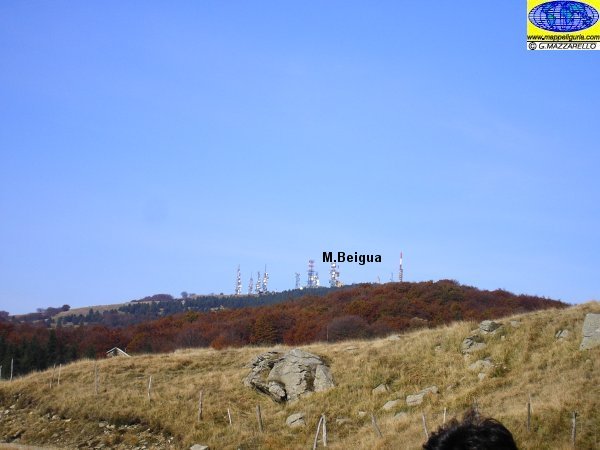
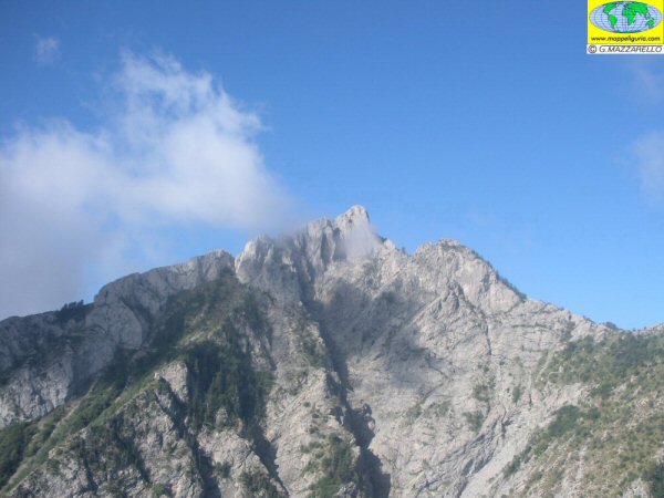
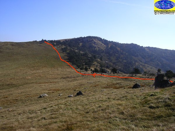
Panorama verso la rotonda vetta del Beigua
Panorama to the round summit of Beigua
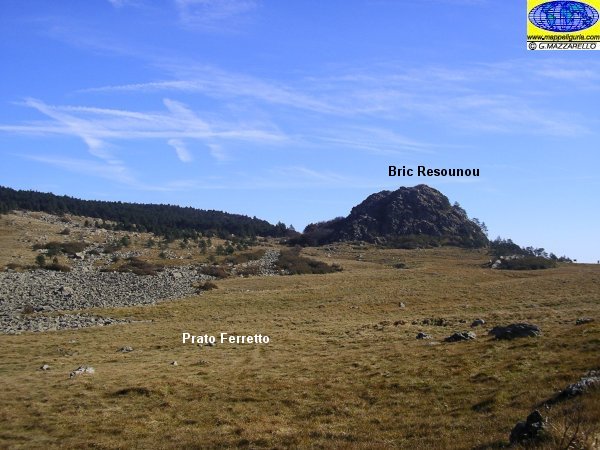
Il Bric Resonnou con a sinistra il "Block Field" di Prato Ferretto
The Bric Resonnou with on left the "Block Field" of Prato Ferretto
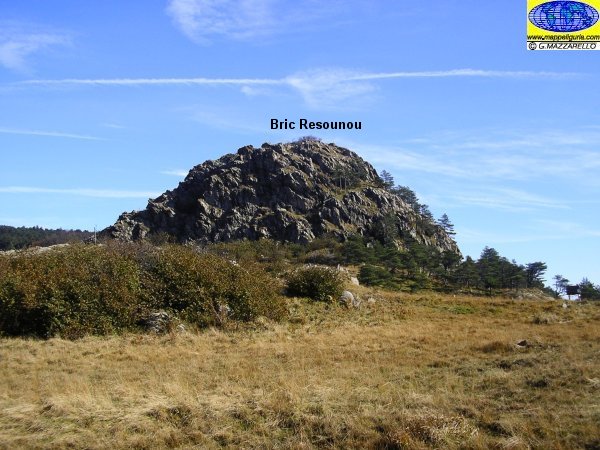
La rocciosa cima del Bric Resonnou
The rocky summit of Bric Resonnou
Lungo l'Alta Via verso la Cima del Pozzo
Along the Alta Via towards the Cima del Pozzo
Il piccolo riparo della Cima del Pozzo
The small shelter of Cima del Pozzo
L'ampia sella prativa del Passo Piani di Lerca
The wide grassy saddle of the Passo Piani di Lerca
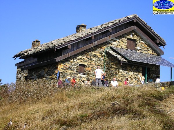
Il bel Rifugio Argentea
The beautiful Rifugio Argentea
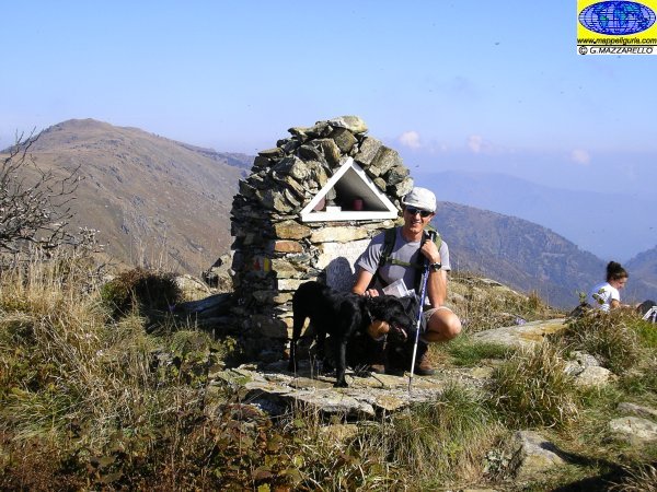
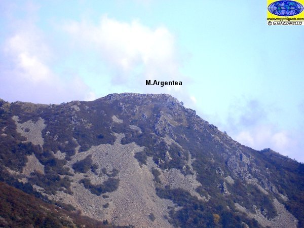
Sulla vetta dell'Argentea
On the summit of Argentea
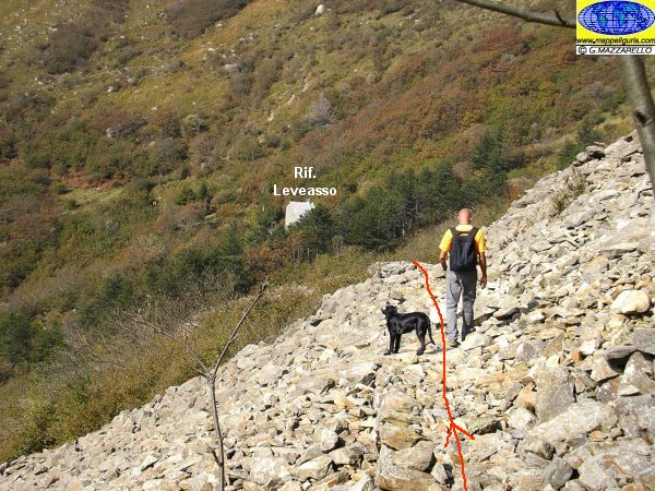
Lungo la mulattiera per il rifugio Leveasso
Along the mule track to the Shelter Leveasso
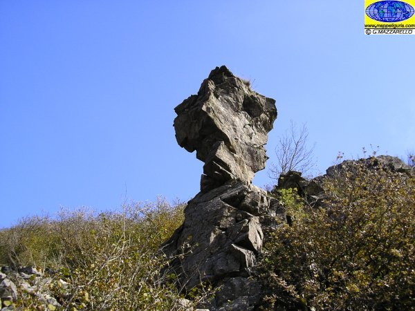
Il grande fungo in pietra poco prima del rifugio Leveasso
The big stone mushroom just before the shelter Leveasso
Attraversando il "Block Stream" dell'Argentea
Crossing the "Block Stream" of Argentea
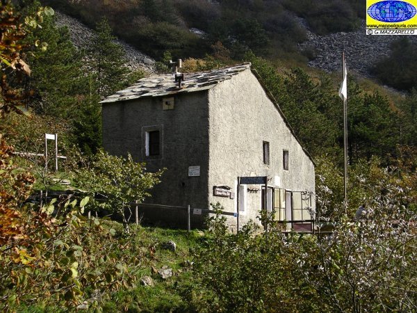
Il rifugio Leveasso o Padre Rino
The shelter Leveasso or Padre Rino
Il versante ovest dell'Argentea con ben evidente il "Block Stream"
The west side of Argentea with evident the "Block Stream"
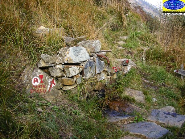
La Fonte Spinsu
The Source Spinsu
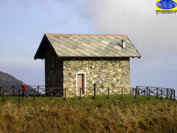
La bella casetta del Rifugio Miera
The beautiful house of Shelter Miera
NOTE /NOTICE
Pur avendo prestato la massima attenzione nella stesura della descrizione del percorso, a causa della mutevolezza del territorio, della variabilita' delle condizioni meteo e di eventuali errori od imprecisioni o giudizi soggettivi indicati nel presente testo, l'autore declina ogni responsabilita' per eventuali incidenti che potrebbero verificarsi. Chi desidera effettuare questo percorso lo fa a proprio rischio e pericolo.
In the description of the route I have done the greatest care, but because of the changing nature of the area, the variability of weather conditions and any errors or inaccuracies or subjective judgments referred to in this text, the author disclaims all responsibility for any accidents that may occur. Those wishing to go this route you do so at your own risk.
Chiunque desiderasse avere maggiori informazioni su questo itinerario, mi
puo' contattare.
Do you want more information about this route?
Please write me
