
![]()
Itinerari TREKKING - Provincia di La Spezia
TREKKING routes - La Spezia district
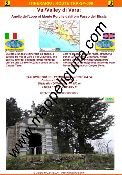
SP-008
Alta Val di Vara: Anello del Monte Porcile dal Passo del Biscia
High Vara Valley: Loop of Mount Porcile starting from Passo del Biscia
DATA/DATE
Maggio 2013
May 2013
NOTE GENERALI / GENERAL NOTES
Questo � un facile itinerario ad anello, a cavallo tra Val di Vara e Val Graveglia, che sale su uno dei pi� panoramici monti del crinale che dal Monte Zatta scende verso le Cinque Terre.
This is an easy circular route, straddling Val di Vara and Val Graveglia, which climbs up one of the most panoramic mountains of the ridge that descends from Monte Zatta towards Cinque Terre.
DATI SINTETICI DEL PERCORSO / ROUTE DATA
Distanza / Distance: 13 km
Dislivello / Difference: +/-450 m
Tempo / Time: 3:30-4:00 h
LOCALITA' DI PARTENZA / STARTING PLACE
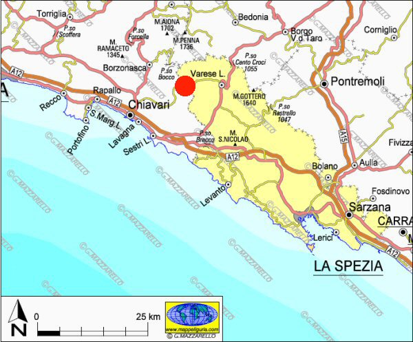
Il percorso inizia dal Passo del Biscia, situato nel comune di Ne, sul confine tra la provincia di Genova e di La Spezia.
The route starts from Passo del Biscia, located in the municipality of Ne, on the border between the province of Genoa and La Spezia.
COME ARRIVARE / HOW TO REACH STARTING PLACE
![]() Dall�uscita del casello di Lavagna dell'autostrada A10, prendiamo a destra per la Val Graveglia e poi ancora a destra per Ne. Risaliamo tutta la valle fino al Passo del Biscia.
Dall�uscita del casello di Lavagna dell'autostrada A10, prendiamo a destra per la Val Graveglia e poi ancora a destra per Ne. Risaliamo tutta la valle fino al Passo del Biscia.
Dall�uscita del casello di Carrodano dell�autostrada A10 prendiamo per Varese Ligure e poi continuiamo a salire per il Passo del Biscia.
From the exit of Lavagna of the A10 motorway, we turn right towards Valle Graveglia and then right again towards Ne. We go up the whole valley up to Passo del Biscia.
From the exit of Carrodano of the A10 motorway we take to Varese Ligure and then we continue to climb for the Passo del Biscia.
PERIODO / WHEN TO GO
Tutto l'anno. In inverno e' possibile trovare neve e ghiaccio.
All the year. In winter you can meet traits snowy and / or icy.
DIFFICOLTA' / DIFFICULTIES
Secondo la scala CAI: T-E (Turistica-Escursionistica).
Il percorso si svolge su sentieri parzialmente segnalati, ma sempre ben evidenti e senza difficolt�.
According to CAI classification: T-E (for Tourist - Normal Hiker).
The route takes place on partially marked paths, but always clearly visible and without difficulty.
SCHEDA PERCORSO / ROAD-BOOK
LIBRETTO DI 12 PAGINE CON TUTTI I DATI PER EFFETTUARE L'ITINERARIO
BOOKLET OF 12 PAGES WITH INSIDE ALL INFOMATIONS TO MAKE THE ROUTE
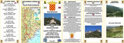
CARTE DI DETTAGLIO / DETAILED MAPS
Tutto il percorso descritto e' contenuto nelle seguenti tavole della collana
mini MAPPE OUTDOOR ACTIVITIES
This route is showed on following
mini MAPPE OUTDOOR ACTIVITIES type maps
Per raggiungere la localita' di partenza e' utile utilizzare la seguente tavola della
collana mini MAPPE CAR
To reach starting places is useful following
mini MAPPE CAR type map
Sei interessato alle CARTE DI DETTAGLIO di questo percorso?
CONTATTAMI
Are you interested about DETAILED MAPS of this route?
WRITE ME
QUALCHE FOTO / SOME PICTURES
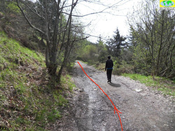
Lungo la strada sterrata poco dopo il Passo del Biscia
Along the dirt road shortly after the Passo del Biscia
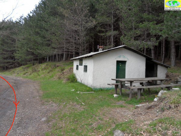
Nei pressi del Rifugio della Forestale
At Rifugio della Forestale
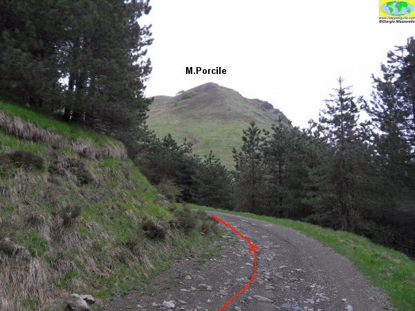
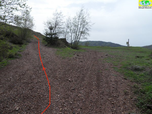
Lungo la strada sterrata
Along the dirt road
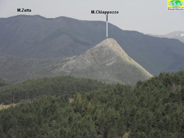
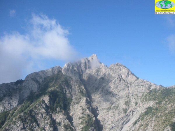
Panorama verso il monte Zatta e il monte Chiappozzo
Panorama towards Mount Zatta and Mount Chiappozzo
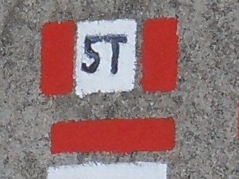
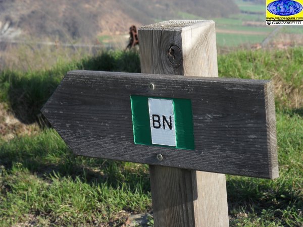
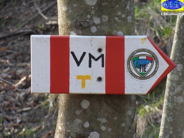
Nei pressi del bivio dove lasciamo il sentiero con il segnavia 5T
Near the junction where we leave the path with the trail-sign 5T
Nei pressi del bivio dove si lascia il sentiero 5T
Near the junction where we leave the path with the trail-sign 5T
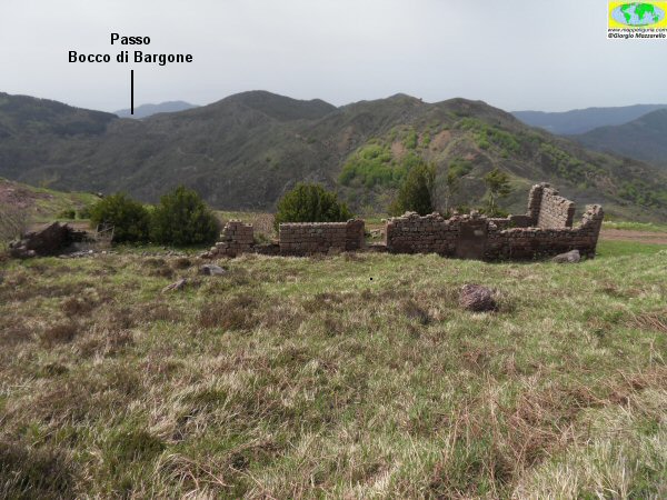
I ruderi di uno degli edifici delle vecchie miniere presenti nel versante sud del monte Porcile
The ruins of one of the buildings of the old mines on the south side of Mount Porcile
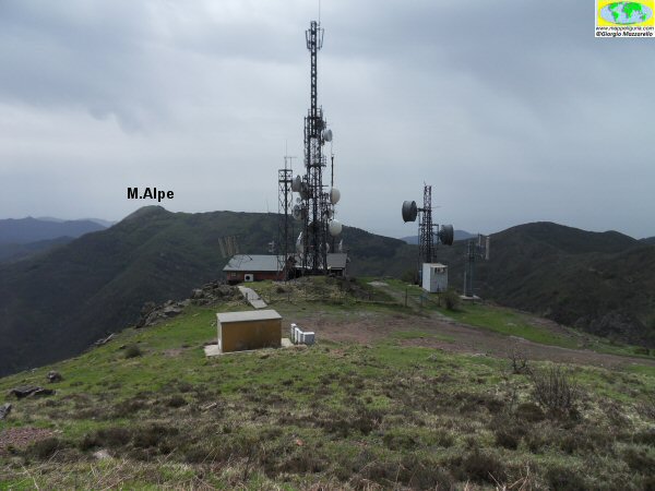
Le grosse antenne presenti poco prima della salita al monte Porcile
The large antennas present just before the ascent to Monte Porcile
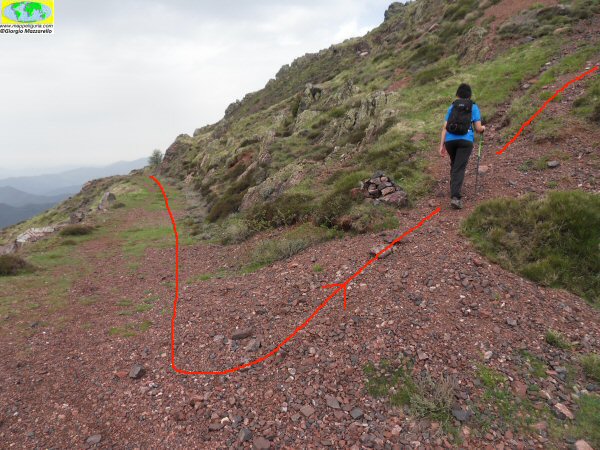
Dove finisce la strada sterrata e inizia la salita su sentiero pedonale per il monte Porcile
Where the dirt road ends and start the climb on the foot-path to Mount Porcile
Lungo la salita
Along the climb
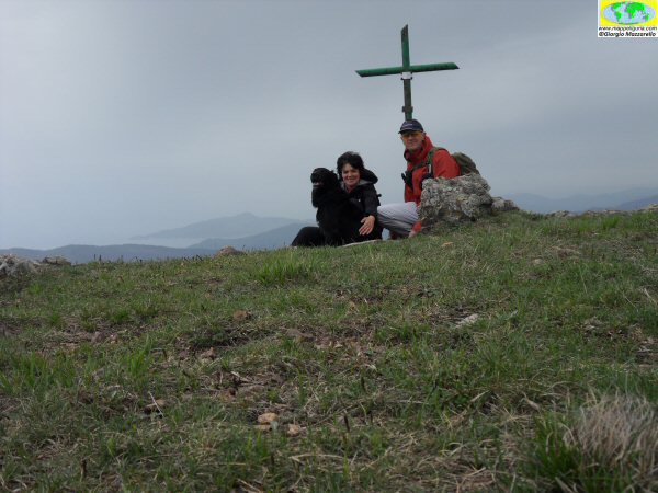
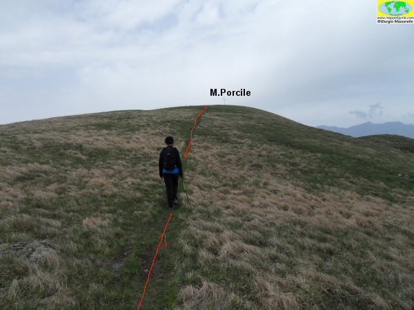
In vetta al monte Porcile
On the summit of Mount Porcile
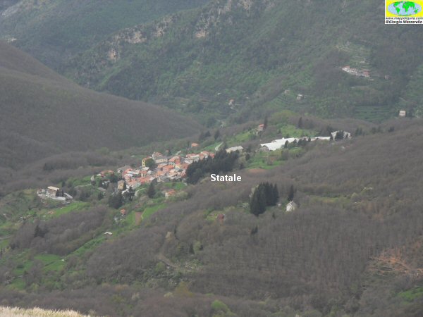
Panorama sul borgo di Statale
Panorama on the village of Statale
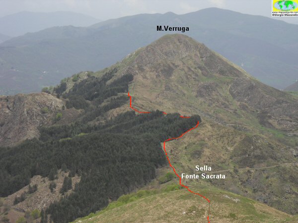
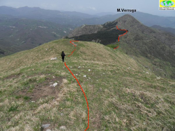
Panorama verso il monte Verruga
Panorama towards Mount Verruga
Scendendo nel versante nord del monte Porcile
Going down along the northern side of Monte Porcile
Nei pressi dei grossi alberi di faggio nel versante nord del monte Porcile
Near the large beech trees in the northern slope of Mount Porcile
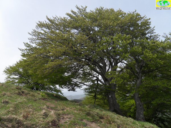
Nei pressi dei grossi alberi di faggio nel versante nord del monte Porcile
Near the large beech trees in the northern slope of Mount Porcile
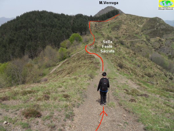
Verso la sella della Fonte Sacrata
Towards the saddle of the Fonte Sacrata
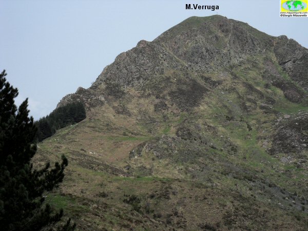
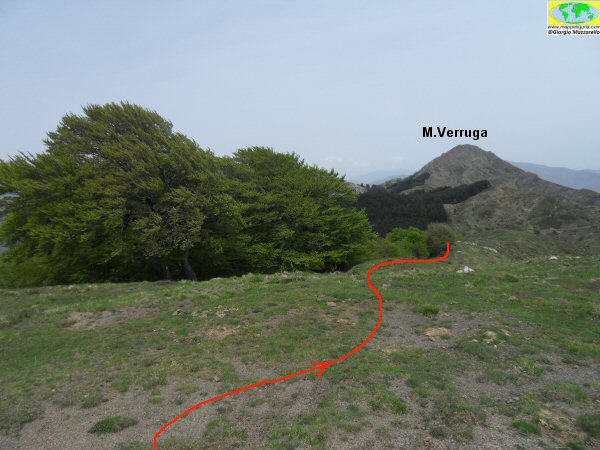
La sagoma del monte Verruga
The silhouette of Mount Verruga
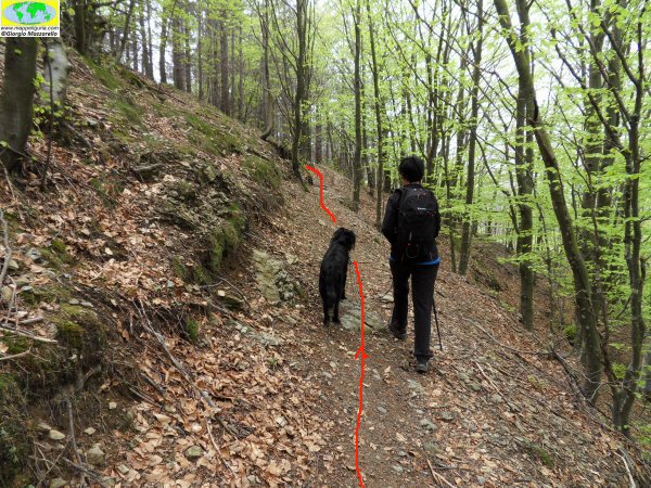
Lungo il sentiero nel versante nord del monte Porcile

Lungo il sentiero nel versante nord del Porcile
Along the path on the north side of Mount Porcile
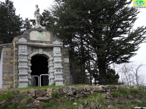
La piccola cappella presente al passo del Biscia
The small chapel at the Passo del Biscia
NOTE /NOTICE
Pur avendo prestato la massima attenzione nella stesura della descrizione del percorso, a causa della mutevolezza del territorio, della variabilita' delle condizioni meteo e di eventuali errori od imprecisioni o giudizi soggettivi indicati nel presente testo, l'autore declina ogni responsabilita' per eventuali incidenti che potrebbero verificarsi. Chi desidera effettuare questo percorso lo fa a proprio rischio e pericolo.
In the description of the route I have done the greatest care, but because of the changing nature of the area, the variability of weather conditions and any errors or inaccuracies or subjective judgments referred to in this text, the author disclaims all responsibility for any accidents that may occur. Those wishing to go this route you do so at your own risk.
Chiunque desiderasse avere maggiori informazioni su questo itinerario, mi
puo' contattare.
Do you want more information about this route?
Please write me
