
![]()
Itinerari TREKKING - PIEMONTE
TREKKING routes - PIEMONTE
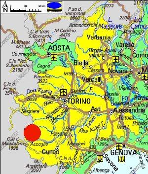
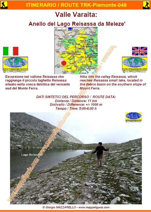
TRK-Piemonte-048 Valle Varaita: Anello del Lago Reisassa da Meleze'
DATA/DATE
Luglio 2014
July 2014
NOTE GENERALI / GENERAL NOTES
Escursione nel vallone Reisassa che raggiunge il piccolo laghetto Reisassa situato nella conca detritica del versante sud del Monte Ferra.
Hike into the valley Reisassa, which reaches Reisassa small lake, located in the debris basin on the southern slope of Mount Ferra.
DATI SINTETICI DEL PERCORSO / ROUTE DATA
Distanza / Distance: 11 km
Dislivello / Difference: +/-1000 m
Tempo / Time: 5:00-6:00 h
LOCALITA' DI PARTENZA / STARTING PLACE
Si parte dal Rifugio Meletze� nel comune di Bellino (CN)
The route starts from the Refuge Meletze' in the municipality of Bellino (CN)
COME ARRIVARE / HOW TO REACH STARTING PLACE
![]() Dall'uscita del casello di Cuneo dell'Autostrada A33 prendiamo per Busca
e poi per Costigliole Saluzzo, dove deviamo a sinistra per salire la Valle Varaita.
Nei pressi di Casteldelfino deviamo a sinistra per Bellino e percorriamo tutta
la Valle di Bellino fino quasi al termine della strada asfaltata, dove lasciamo
l�auto nel grosso spiazzo presso il Rifugio Meletze�.
Dall'uscita del casello di Cuneo dell'Autostrada A33 prendiamo per Busca
e poi per Costigliole Saluzzo, dove deviamo a sinistra per salire la Valle Varaita.
Nei pressi di Casteldelfino deviamo a sinistra per Bellino e percorriamo tutta
la Valle di Bellino fino quasi al termine della strada asfaltata, dove lasciamo
l�auto nel grosso spiazzo presso il Rifugio Meletze�.
From the exit of the motorway A33 Cuneo, we take for Busca and then Costigliole Saluzzo, where we turn left to go up the valley Cuneo. Near Casteldelfino, we turn left toward Bellino and walk across the Bellino Valley until we reach Meletze� Shelter, where we leave the car in the large open area along the road.
PERIODO / WHEN TO GO
Da inizio estate ad autunno inoltrato.
From early summer to late autumn.
DIFFICOLTA' / DIFFICULTIES
Secondo la scala CAI: E-EE (Escursionistica-per Escursionisti Esperti)
Il percorso si svolge su strade sterrate e su sentieri non sempre evidenti e segnalati in parte.
![]()
According to the scale CAI: E-EE (Normal Hiker - Expert Hikers).
The route takes place on dirt roads and trails, which are not always obvious
and which are not fully provided of trail-sign.
SCHEDA PERCORSO / ROAD-BOOK
LIBRETTO DI 10 PAGINE CON TUTTI I DATI PER EFFETTUARE L'ITINERARIO
BOOKLET OF 10 PAGES WITH INSIDE ALL INFOMATIONS TO MAKE THE ROUTE
QUALCHE FOTO / SOME PICTURES
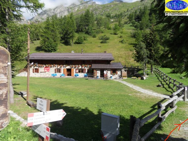
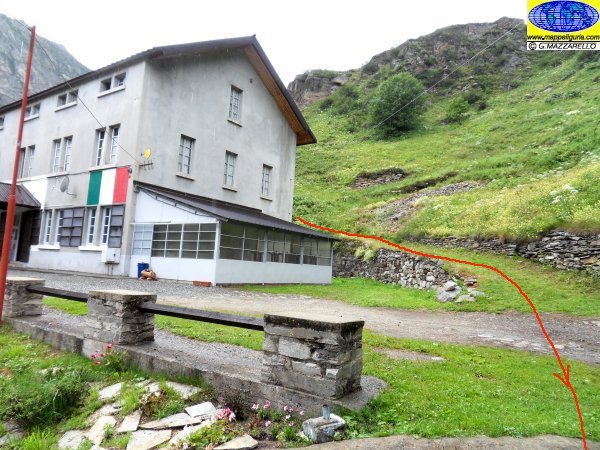
Presso il Rifugio Meltze'
At Meltze' Shelter
Presso il Rifugio Meltze'
At Meltze' Shelter
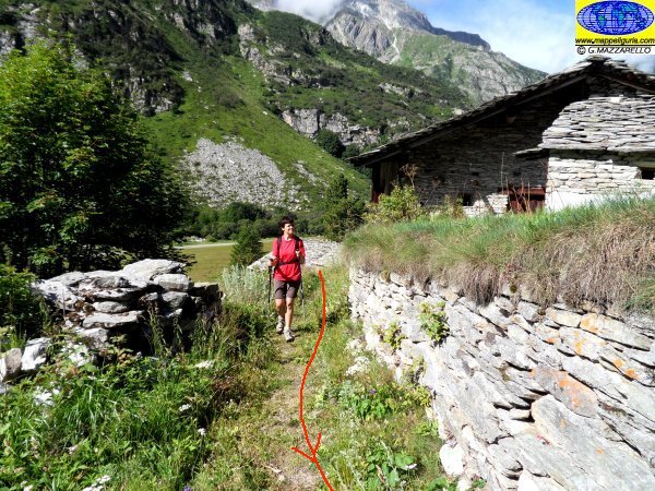
Le prime case che si incontrano poco dopo la partenza
First houses we meet just after start of route
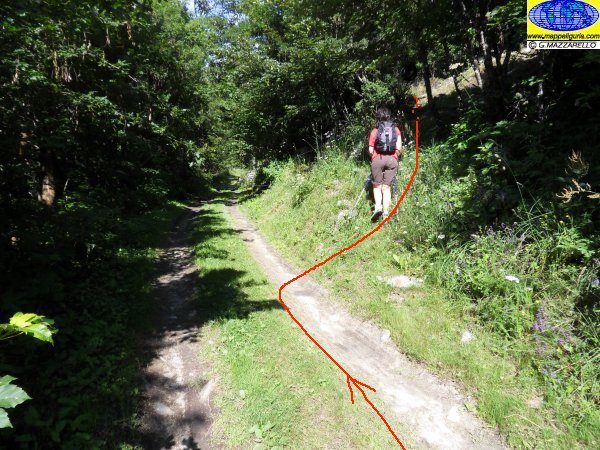
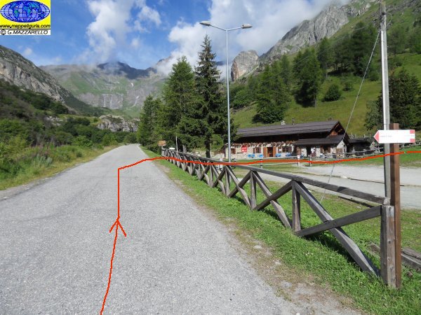
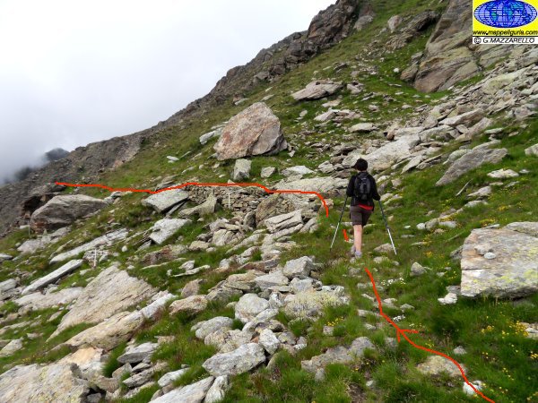
Il bivio poco evidente dopo avere percorso pochi metri su di una sterrata poco dopo la partenza
At the crossroads, not obvious, we meet after traveling a few meters on a dirt road shortly after the start
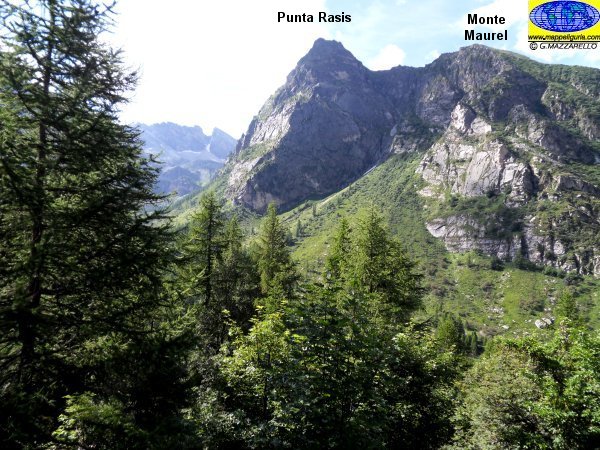
Panorama sulla Punta Rasis
Panorama on Punta Rasis
Il bivio dove si lascia a destra il sentiero per il Colle Bondormir
At the fork where we leave right the path to Col Bondormir
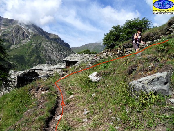
Presso Grange Cheiron Superiori
At Grange Cheiron Superiori
Panorama su S.Anna
Panorama over S.Anna
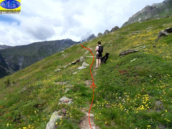
Verso la Costa dell'Oiso
Towards Costa dell'Oiso
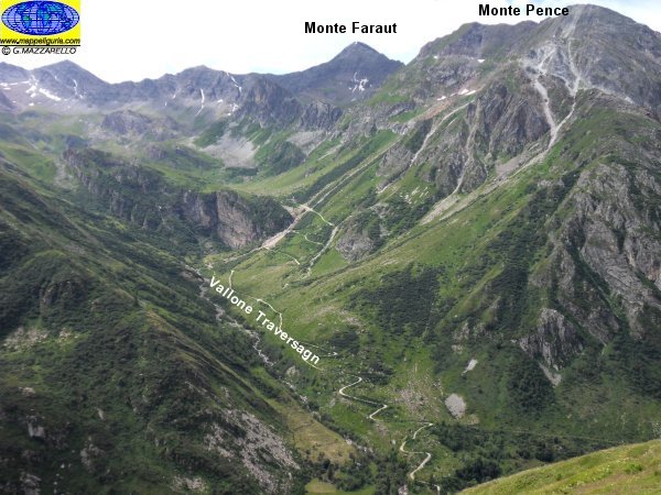
Panorama sulla Valle Traversagn
Panorama over Traversagn valley
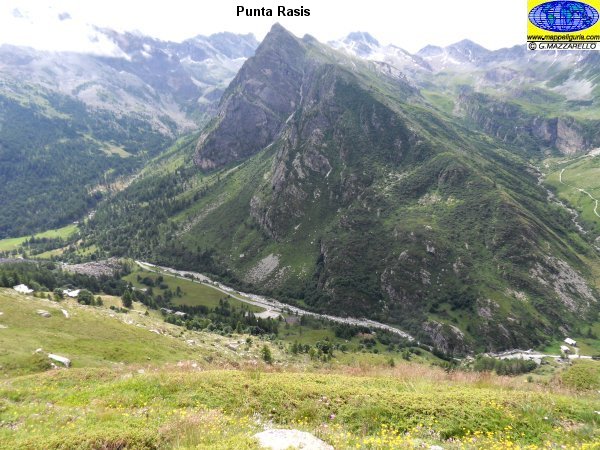
Panorama sulla Punta Rasis e sulla Valle di Bellino
Panorama on Punta Rasis ad over Bellino Valley
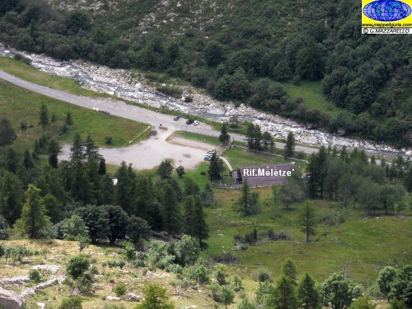
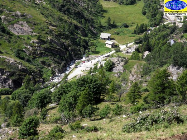
Panorama sullo spiazzo presso il Rifugio Meltze'
Panorama over Maltze' Shelter parking area
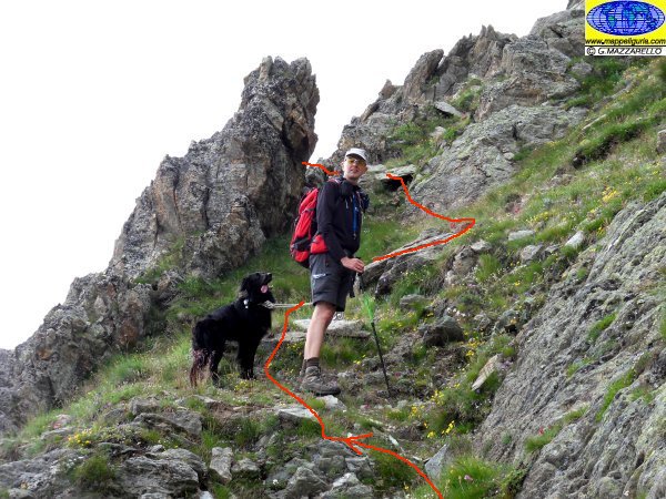
Il bivio per il Monte Fera
Al tre fork to Fera Mount
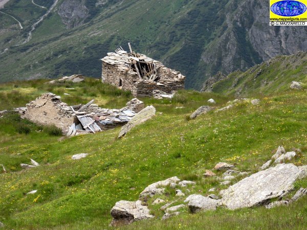
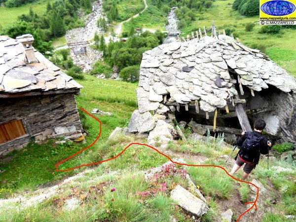
Grange Reisassa
Grange Reisassa
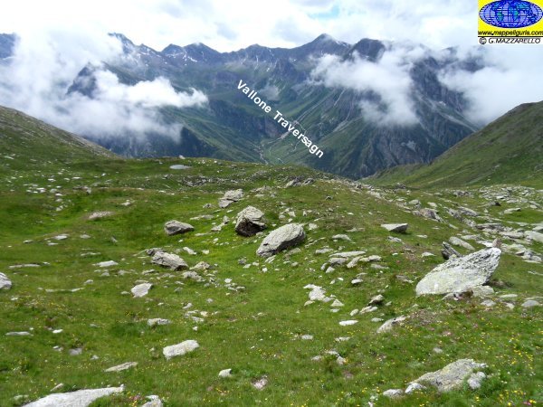
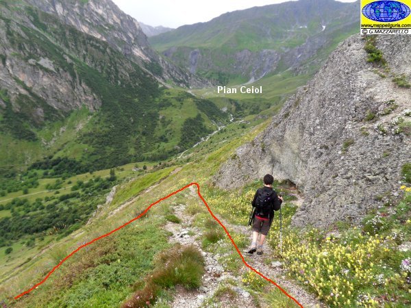
Panorama sul Vallone Traversagn
Panorama over Traversagn Valley
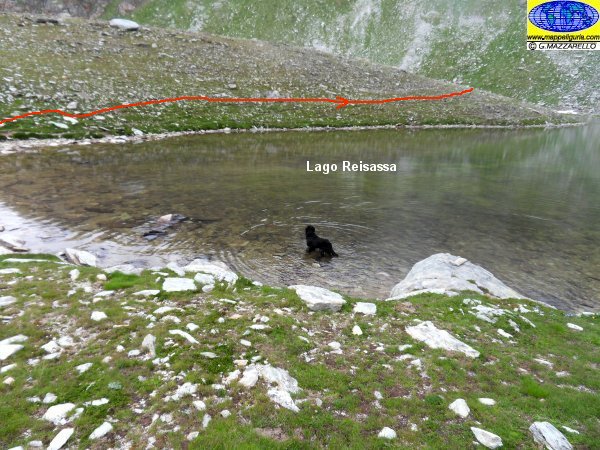
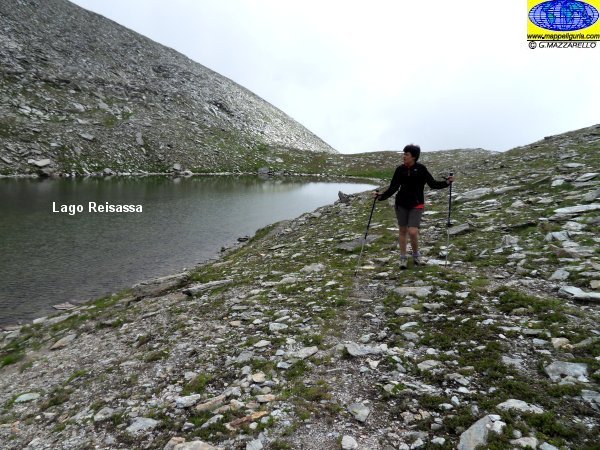
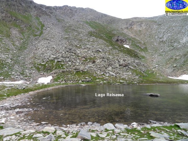
Lago Reisassa
Reisassa Lake
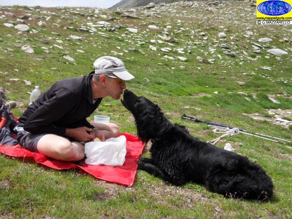
Tra amici si condivide il cibo
Between friends we share our food
Lungo il Lago Reisassa
Along Reisassa Lake
Lago Reisassa
Reisassa Lake
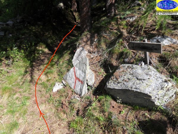
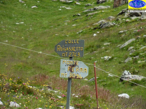
Verso il Colle Reisassetto
Towards Colle Reisassetto
Verso il Colle Reisassetto
Towards Colle Reisassetto
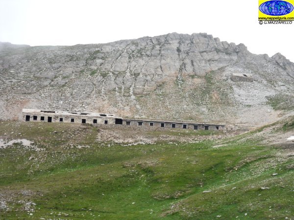
La caserma presso il Colle Reisassetto
The barracks at the Colle Reisassetto
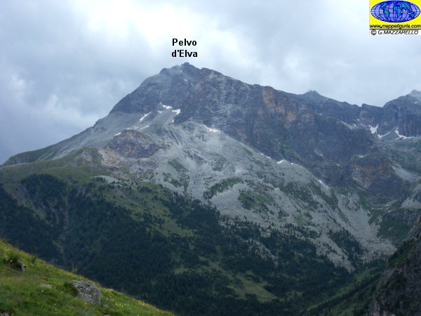
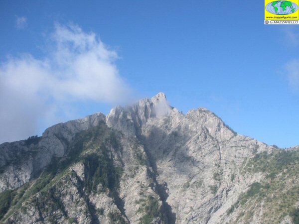
Panorama sul Pelvo d'Elva
Panorama of Pelvo d'Elva
Scendendo verso Grange Rochas
Going down to Grange Rochas
Grange Rochas Inferiori
Grange Rochas Inferiori
La colonia presso S.Anna
The colony at St. Anna
NOTE /NOTICE
Pur avendo prestato la massima attenzione nella stesura della descrizione del percorso, a causa della mutevolezza del territorio, della variabilita' delle condizioni meteo e di eventuali errori od imprecisioni o giudizi soggettivi indicati nel presente testo, l'autore declina ogni responsabilita' per eventuali incidenti che potrebbero verificarsi. Chi desidera effettuare questo percorso lo fa a proprio rischio e pericolo.
In the description of the route I have done the greatest care, but because of the changing nature of the area, the variability of weather conditions and any errors or inaccuracies or subjective judgments referred to in this text, the author disclaims all responsibility for any accidents that may occur. Those wishing to go this route you do so at your own risk.
Chiunque desiderasse avere maggiori informazioni su questo itinerario, mi
puo' contattare.
Do you want more information about this route?
Please write me
