
![]()
Itinerari TREKKING - PIEMONTE
TREKKING routes - PIEMONTE
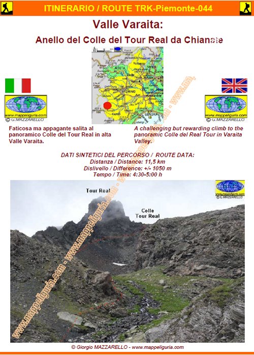
TRK-Piemonte-044-Valle Varaita: Anello del Colle del Tour Real da Chianale
DATA/DATE
Luglio 2014
July 2014
NOTE GENERALI / GENERAL NOTES
Faticosa ma appagante salita al panoramico Colle del Tour Real in alta Valle Varaita.
A challenging but rewarding climb to the panoramic Colle del Real Tour in Varaita Valley.
DATI SINTETICI DEL PERCORSO / ROUTE DATA
Distanza / Distance: 13,5 km
Dislivello / Difference: +/-950 m
Tempo / Time: 5:00-5:30 h
LOCALITA' DI PARTENZA / STARTING PLACE
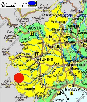
il percorso parte da Chianale frazione di Pontechianale (CN).
The route starts from Chianale fraction of Pontechianale (CN).
COME ARRIVARE / HOW TO REACH STARTING PLACE
![]() Dall'uscita del casello di Cuneo dell'Autostrada A33 prendiamo per Busca e poi per
Costigliole Saluzzo, dove deviamo a sinistra per risalire tutta la Valle Varaita fino
a raggiungere Pontechianale, che superiamo per raggiungere poco dopo Chianale.
Poco dopo il paese si devia sulla strada asfaltata a destra, oltrepassiamo il
torrente e lasciamo l�auto a destra nel grande piazzale adibito a posteggio camper.
Dall'uscita del casello di Cuneo dell'Autostrada A33 prendiamo per Busca e poi per
Costigliole Saluzzo, dove deviamo a sinistra per risalire tutta la Valle Varaita fino
a raggiungere Pontechianale, che superiamo per raggiungere poco dopo Chianale.
Poco dopo il paese si devia sulla strada asfaltata a destra, oltrepassiamo il
torrente e lasciamo l�auto a destra nel grande piazzale adibito a posteggio camper.
From the exit of Cuneo of the motorway A33 we take to Busca and then to Costigliole Saluzzo, where we turn left to climb the entire Valle Varaita up to Pontechianale. We pass Pontechianale to reach shortly after Chianale. Just after the village we turn on the paved road to the right, we past the stream and we leave the car right into the large caravan parking area.
PERIODO / WHEN TO GO
Da inizio estate ad autunno inoltrato.
From early summer to late autumn.
DIFFICOLTA' / DIFFICULTIES
Secondo la scala CAI: EE (Per Escursionisti Esperti)
Il percorso si svolge su sentieri e su tracce di sentiero parzialmente segnalati e con alcuni tratti esposti.
![]()
According to the scale CAI: EE (Excursion for Expert Hikers)
The route follows paths and path-track partially provided of trail-sign and with some exposed sections.
SCHEDA PERCORSO / ROAD-BOOK
LIBRETTO DI 10 PAGINE CON TUTTI I DATI PER EFFETTUARE L'ITINERARIO
BOOKLET OF 10 PAGES WITH INSIDE ALL INFOMATIONS TO MAKE THE ROUTE
QUALCHE FOTO / SOME PICTURES
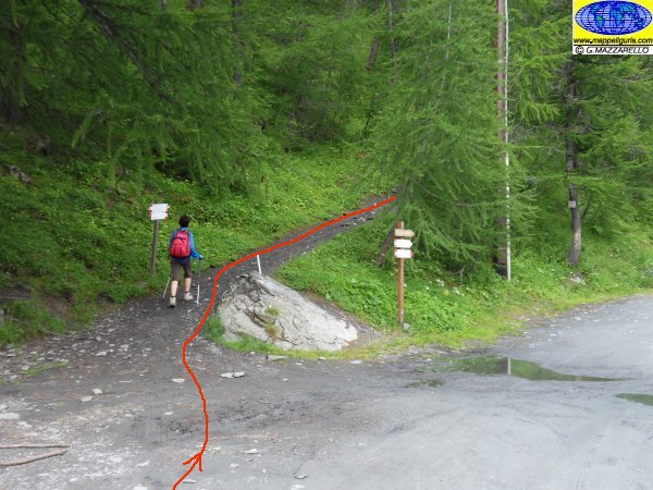
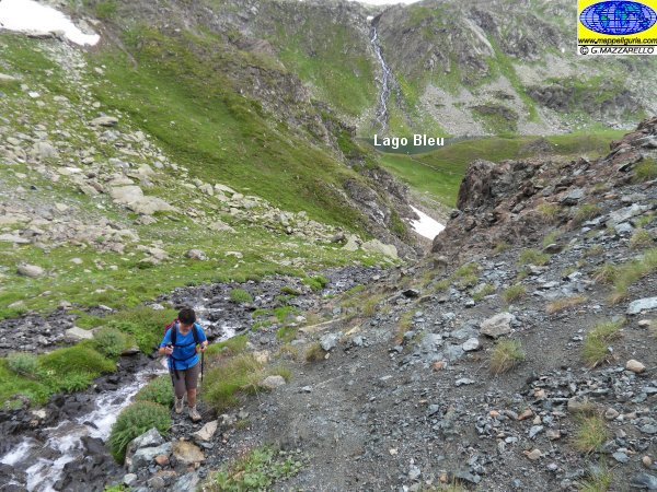
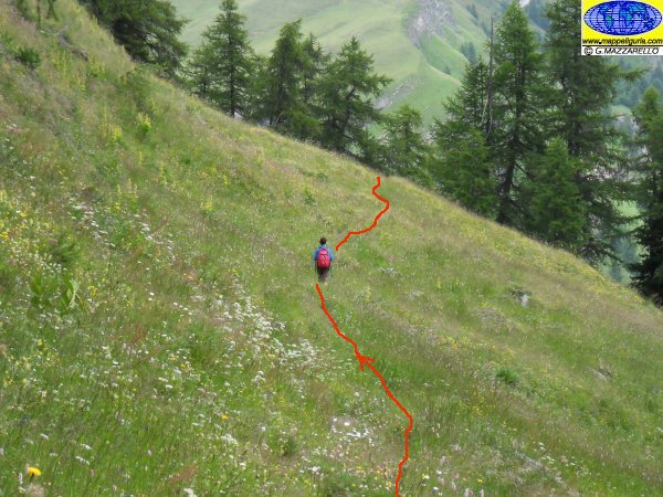
Dove si lascia la strada sterrata e si inizia a salire lungo il sentiero per il Lago Bleu
Where we leave the dirt road and we start to climb along the foot-path to Lake Bleu
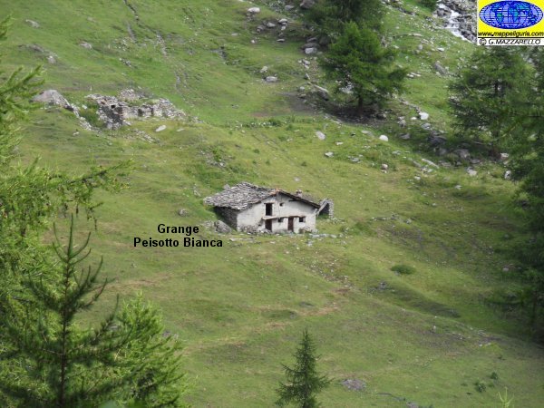
Panorama sulla Grange Peisotta Bianca
Panorama over Grange Peisotta Bianca
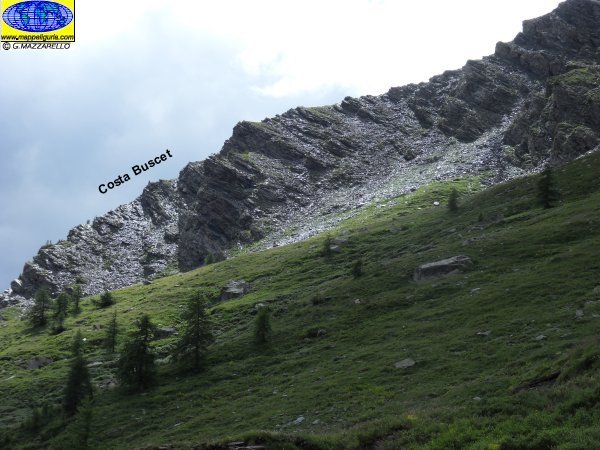
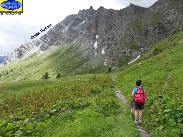
Panorama sulla Costa Buscet
Panorama of Costa Buscet
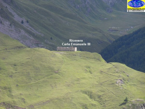
Panorama sul Ricovero Carlo Emanuele III
Panorama over ex shelter Carlo Emanuele III
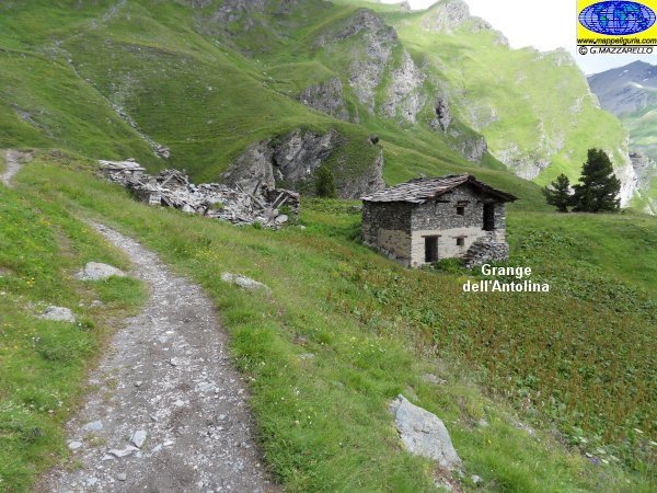
Presso la Grange Antolina
At Grange Antolina
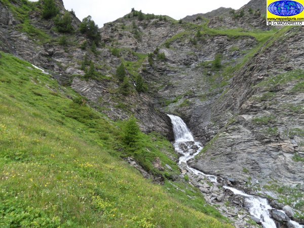
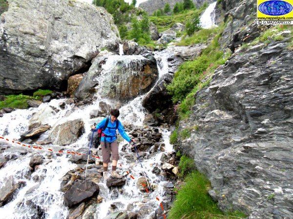
La cascata della Valle Antolina
Valle Antolina waterfall
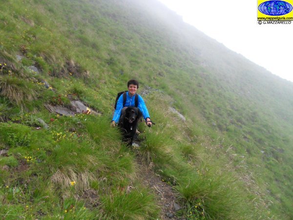
Lungo il sentiero verso il Lago Bleu
Along the path towards Lake Bleu
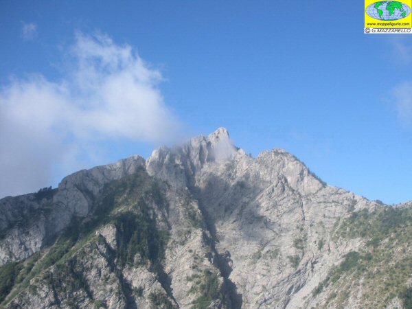
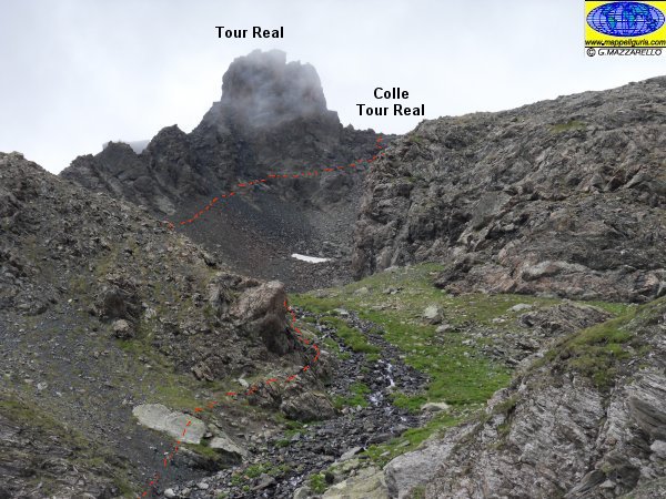
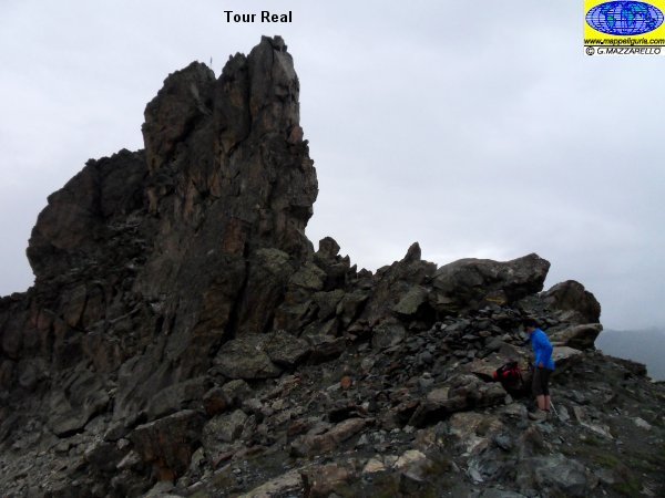
Panorama sul Tour Real
Panorama of Tour Real

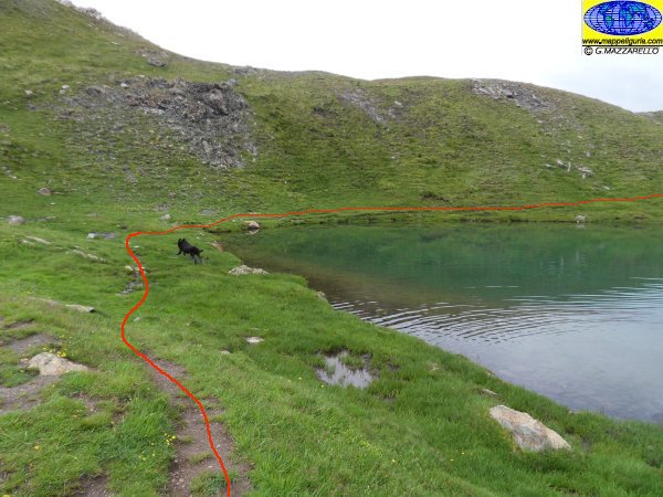
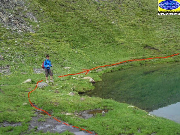
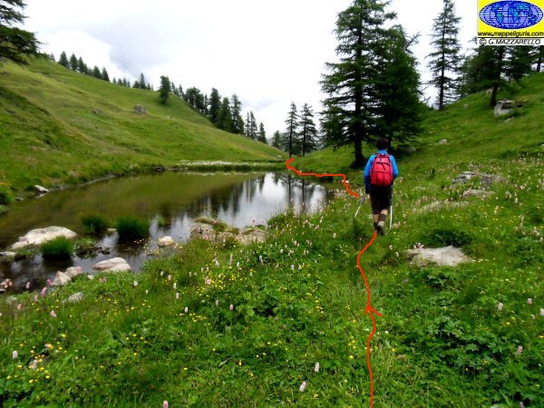
Presso il Lago Bleu
At Bleu Lake
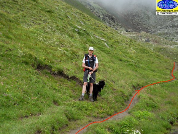
Lungo il sentiero per il Lago Nero
Along the path to Nero Lake
Presso il Lago Nero
At Nero Lake
Presso il Lago Nero
At Nero Lake
Presso il Lago Nero
At Nero Lake
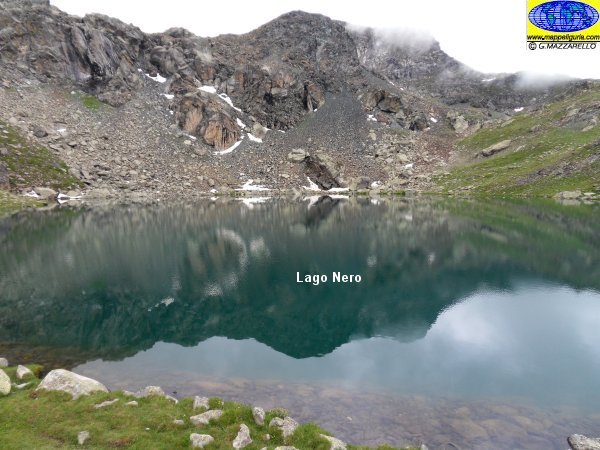
Lago Nero
Nero Lake
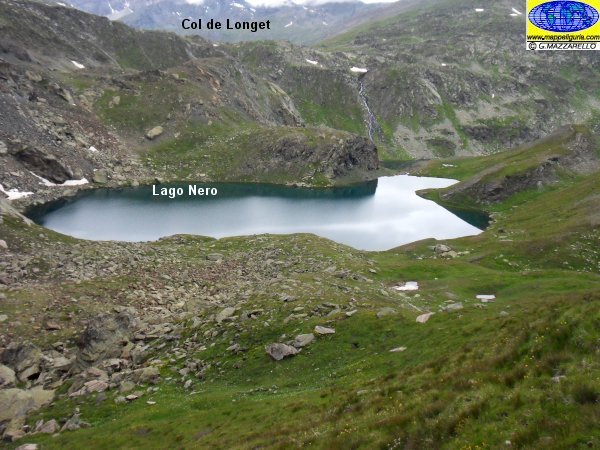
Panorama sul Lago nero dal sentiero che sale al Colle del Tour Real
View on Nero Lake from the path to Colle del Tour Real
Presso il Colle del Tour Real
At Colle del Tour Real
Scendendo nel Vallone Sabirane
View on Naro Lake from the path to Colle del Tour Real
Scendendo nel Vallone Sabirane
Going down to Sabirane valley
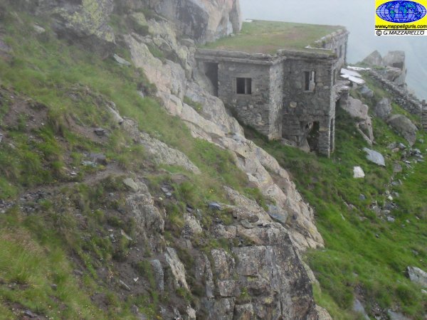
La caserma che si incontra scendendo nel Vallone Sabirane
The barracks we meet going down in the Valley Sabirane
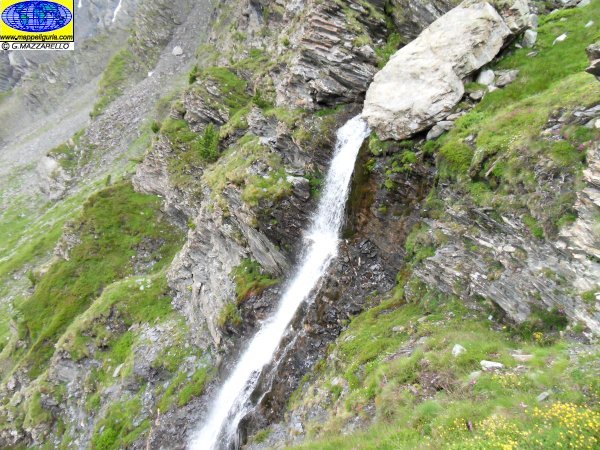
La cascata che si incontra scendendo nel Vallone Sabirane
The waterfall we meet going down in the Valley Sabirane
Scendendo nel Vallone Sabirane
Going down to Sabirane Valley
Scendendo nel Vallone Sabirane
Going down to Sabirane Valley
Il piccolo stagno presso la Grange Torrette
The small pond at the Grange Torrette
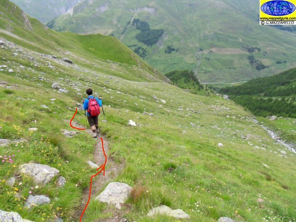
Scendendo verso Chianale
Going down to Chianale
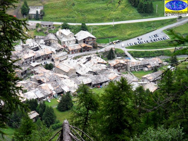
Panorama su Chianale
Chianale
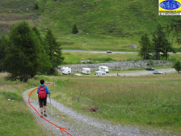
Scendendo verso Chianale
Going down to Chianale
NOTE /NOTICE
Pur avendo prestato la massima attenzione nella stesura della descrizione del percorso, a causa della mutevolezza del territorio, della variabilita' delle condizioni meteo e di eventuali errori od imprecisioni o giudizi soggettivi indicati nel presente testo, l'autore declina ogni responsabilita' per eventuali incidenti che potrebbero verificarsi. Chi desidera effettuare questo percorso lo fa a proprio rischio e pericolo.
In the description of the route I have done the greatest care, but because of the changing nature of the area, the variability of weather conditions and any errors or inaccuracies or subjective judgments referred to in this text, the author disclaims all responsibility for any accidents that may occur. Those wishing to go this route you do so at your own risk.
Chiunque desiderasse avere maggiori informazioni su questo itinerario, mi
puo' contattare.
Do you want more information about this route?
Please write me
