
![]()
Itinerari TREKKING - PIEMONTE
TREKKING routes - PIEMONTE
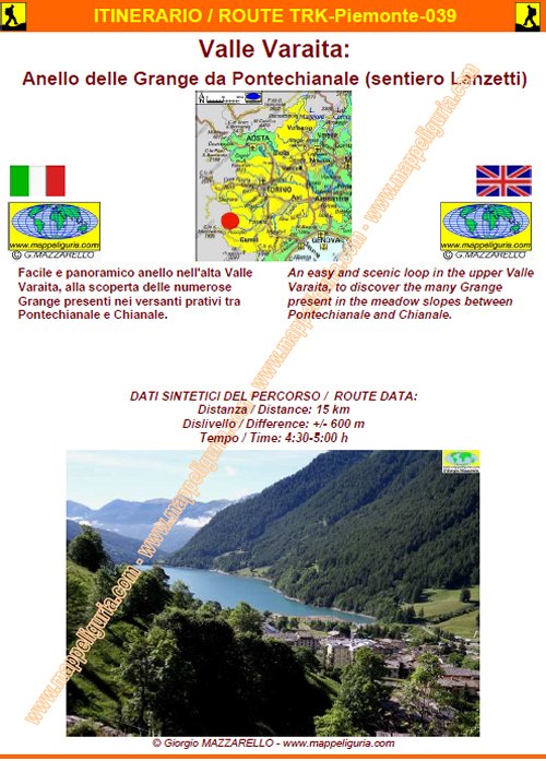
Piemonte039 - Valle Varaita: Anello delle Grange da Pontechianale (sentiero Lanzetti)
DATA/DATE
Luglio 2014
July 2014
NOTE GENERALI / GENERAL NOTES
Facile e panoramico anello nell'alta Valle Varaita, alla scoperta delle numerose Grange presenti nei versanti prativi tra Pontechianale e Chianale.
An easy and scenic loop in the upper Valle Varaita, to discover the many Grange present in the meadow slopes between Pontechianale and Chianale.
DATI SINTETICI DEL PERCORSO / ROUTE DATA
Distanza / Distance: 15 km
Dislivello / Difference: +/-600 m
Tempo / Time: 4:30-5:30 h
LOCALITA' DI PARTENZA / STARTING PLACE
Il percorso parte da Pontechianale (CN)
The route starts from Pontechianale (CN)
COME ARRIVARE / HOW TO REACH STARTING PLACE
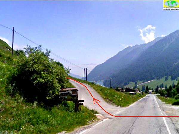
![]() Dall'uscita del casello di Cuneo dell'Autostrada A33 si prende per Busca e poi
per Costigliole Saluzzo, dove si devia a sinistra per risalire tutta la
Valle Varaita fino a raggiungere Pontechianale. Si oltrepassa il borgo e
appena dopo si lascia l'auto presso la deviazione a destra per il
Rifugio Savigliano (piccolo spiazzo a sinistra).
Dall'uscita del casello di Cuneo dell'Autostrada A33 si prende per Busca e poi
per Costigliole Saluzzo, dove si devia a sinistra per risalire tutta la
Valle Varaita fino a raggiungere Pontechianale. Si oltrepassa il borgo e
appena dopo si lascia l'auto presso la deviazione a destra per il
Rifugio Savigliano (piccolo spiazzo a sinistra).
From the exit of Cuneo of the motorway A33, we take for Busca and then for Costigliole Saluzzo, where we turn off to the left to climb the entire Varaita Valley until we reach Pontechianale. We pass the village and soon after we leave the car at the detour on right to the Shelter Savigliano (small square on the left).
PERIODO / WHEN TO GO
Da inizio estate ad autunno inoltrato.
In inverno e' un percorso da fare con le ciaspole.
From early summer to late autumn.
This is a path that can be done in winter with snowshoes.
DIFFICOLTA' / DIFFICULTIES
Secondo la scala CAI: T (Turistica)
Il percorso si svolge su strade asfaltate, strade sterrate e su facili sentieri sempre ben segnalati.
![]()
According to the scale CAI: T (For Tourits).
The whole route runs on paved roads, dirt roads and easy paths, always well marked.
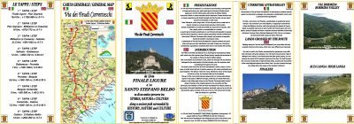
SCHEDA PERCORSO / ROAD-BOOK
LIBRETTO DI 10 PAGINE CON TUTTI I DATI PER EFFETTUARE L'ITINERARIO
BOOKLET OF 10 PAGES WITH INSIDE ALL INFOMATIONS TO MAKE THE ROUTE
QUALCHE FOTO / SOME PICTURES
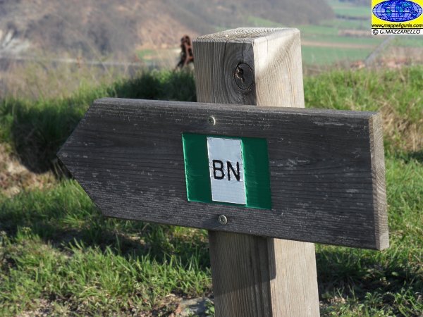
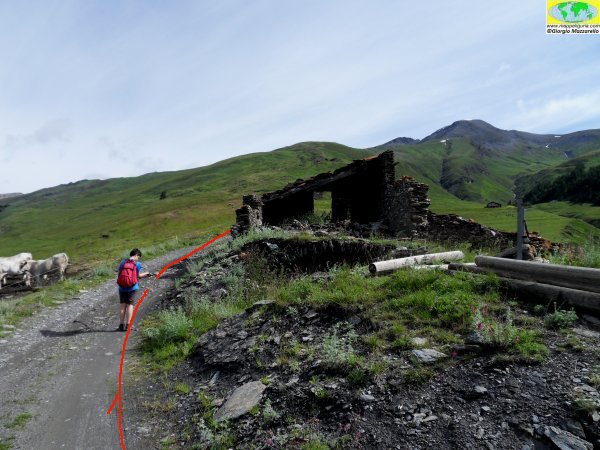
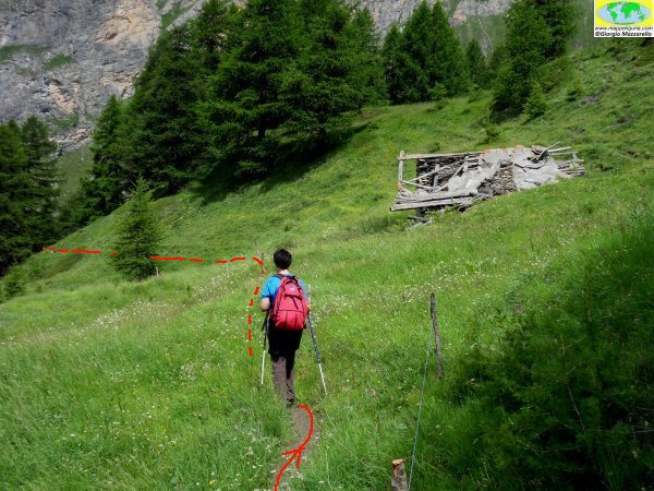
Presso la partenza del percorso
At the start of the path
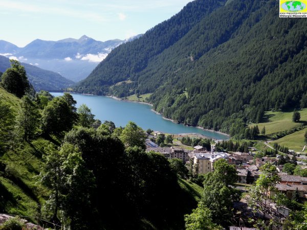
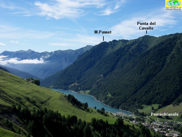
Panorama su Pontechianale e sul Lago
Panorama of Pontechianale and Lake
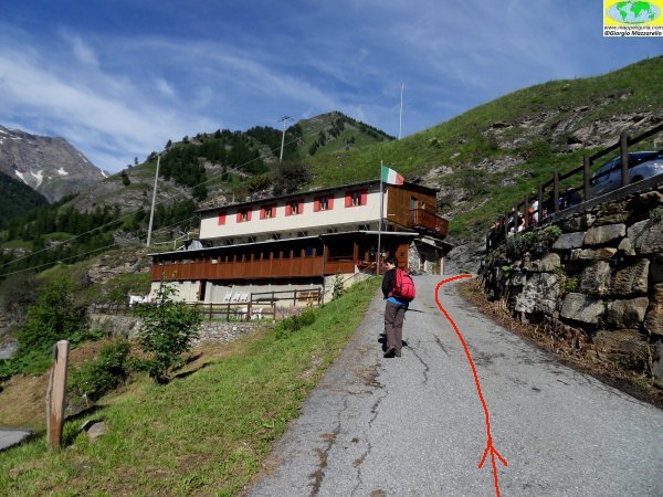
Presso il Rifigio Savigliano
At the Shelter Savigliano
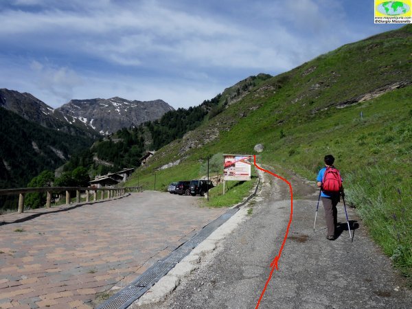
Presso Sellette, dove la strada diventa sterrata
At Sellette, where the road becomes a dirt road
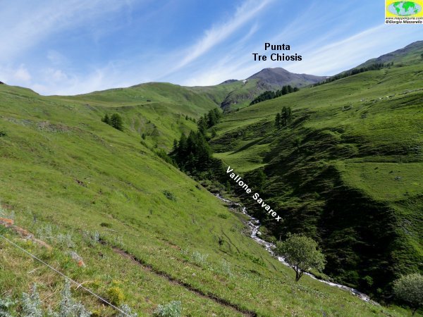
Panorama sul Vallone di Savarex
Panorama of Savarex Valley
Panorama su Pontechianale
Panorama of Pontechianale
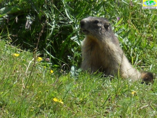
Marmotta
Marmot
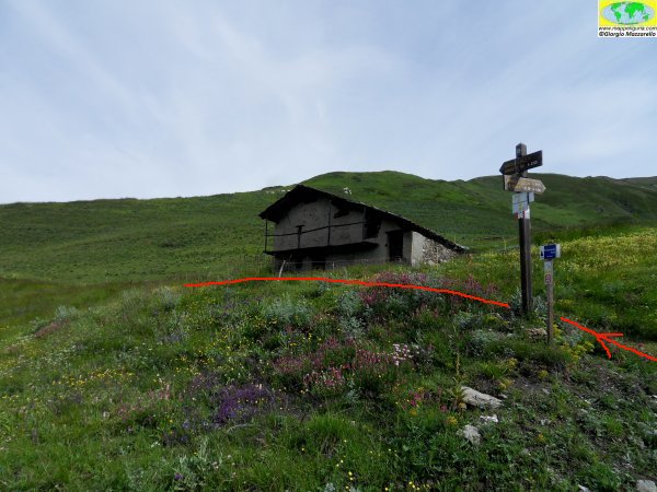
Presso la Grangia Lori
At Grangia Lori
Presso la Grangia Patas, dove si devia a sinistra
At the Grangia Patas, where we turn left
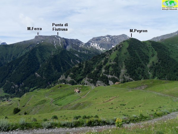
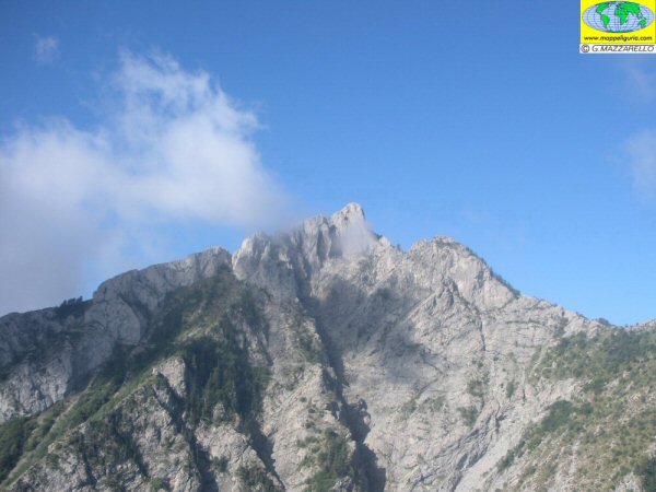
Panorama sul Monte Ferra
Panorama of Mount Ferra
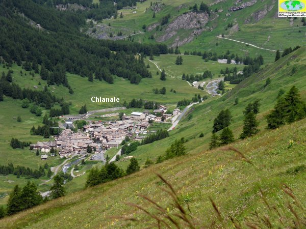
Panorama su Chianale
Panorama of Chianale
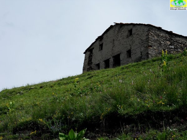
Presso la Grangia Cucet
At Grangia Cucet
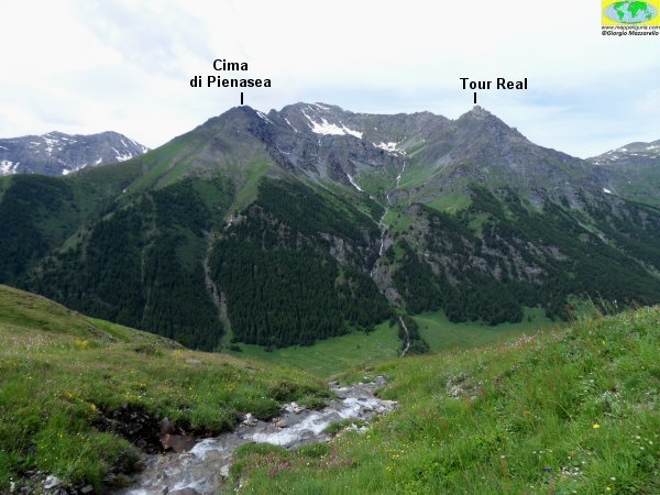
Panorama sul massiccio del Tour Real
Panorama of the Tour Real
Presso la Grangia del Mago
At Grangia del Mago

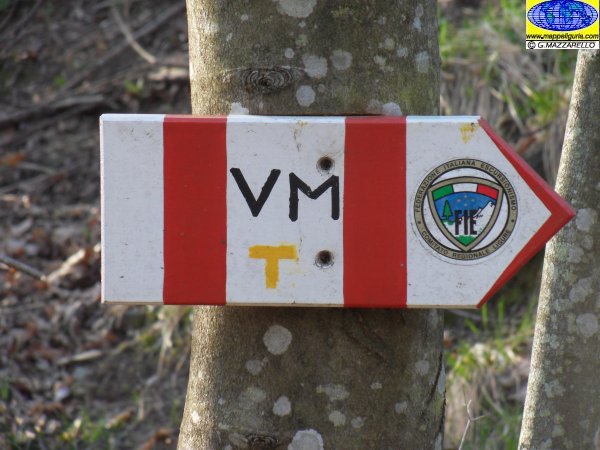
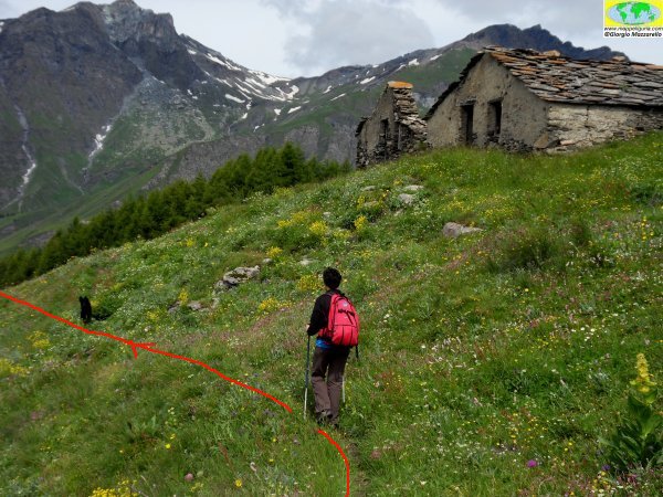
Lungo il percorso
Along the path
Presso la Grangia Pategun
At Grangia Pategun
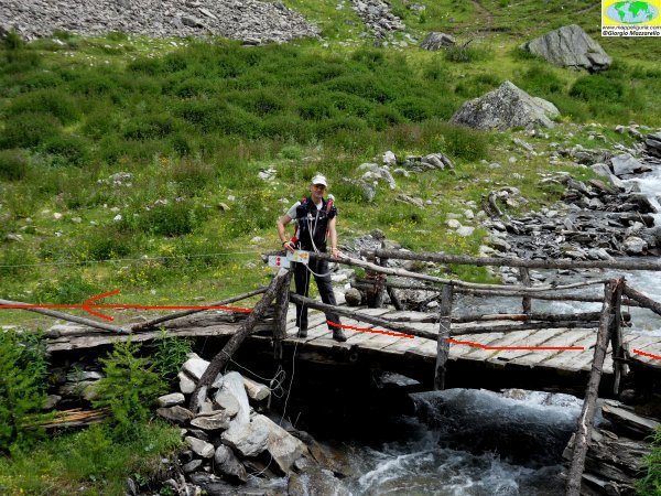
Presso il ponte sul Vallone di Sustra
At the bridge ove Sustra Valley
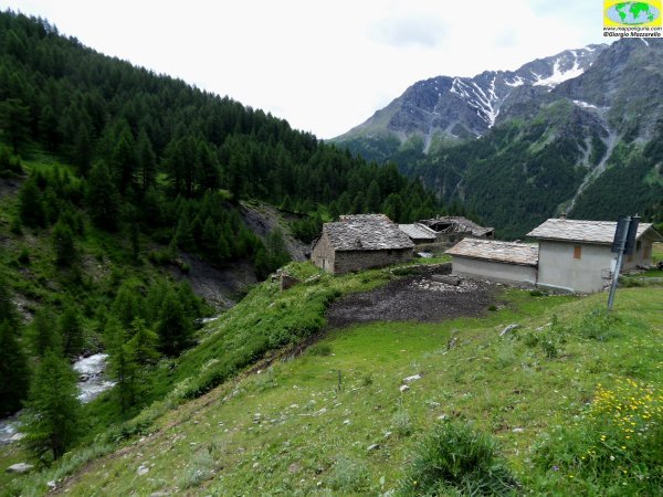
Presso le Grange del Rio
At Grange del Rio
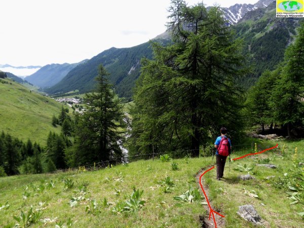
Lungo il sentiero che scende verso Chianale
Along the path down to Chianale
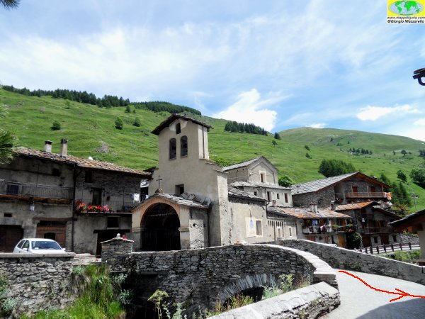
Presso Chianale
At Chianale

Lungo il sentiero per Pontechianale
Along the path to Pontechianale
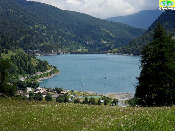
Panorama sul Lago di Pontechianale
Panorama over the Lake of Pontechianale
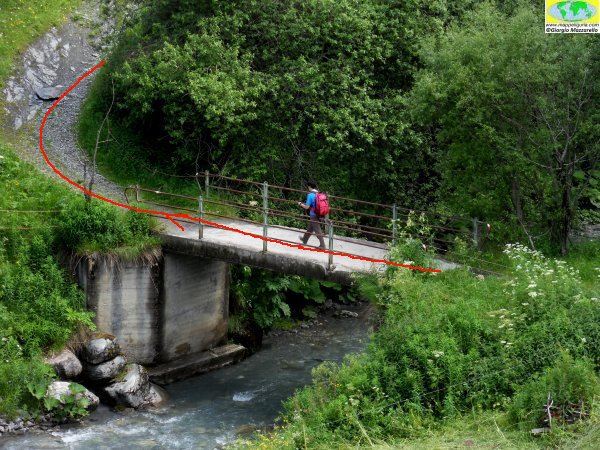
Presso il ponte sul Torrente Varaita
At the bridge ove Varaita River
NOTE /NOTICE
Pur avendo prestato la massima attenzione nella stesura della descrizione del percorso, a causa della mutevolezza del territorio, della variabilita' delle condizioni meteo e di eventuali errori od imprecisioni o giudizi soggettivi indicati nel presente testo, l'autore declina ogni responsabilita' per eventuali incidenti che potrebbero verificarsi. Chi desidera effettuare questo percorso lo fa a proprio rischio e pericolo.
In the description of the route I have done the greatest care, but because of the changing nature of the area, the variability of weather conditions and any errors or inaccuracies or subjective judgments referred to in this text, the author disclaims all responsibility for any accidents that may occur. Those wishing to go this route you do so at your own risk.
Chiunque desiderasse avere maggiori informazioni su questo itinerario, mi
puo' contattare.
Do you want more information about this route?
Please write me
