
![]()
Itinerari TREKKING - Provincia di Genova
TREKKING routes - Genova district
TRK-GE-105
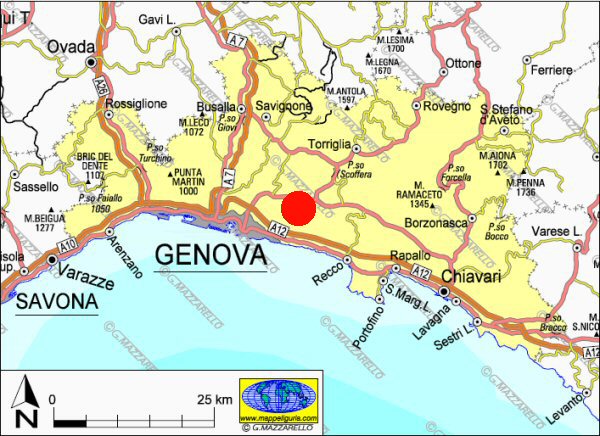
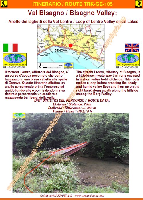
Val Bisagno: Anello dei laghetti della Val Lentro
Bisagno Valley: Loop of Lentro Valley small Lakes
DATA/DATE
Giugno 2012
June 2012
NOTE GENERALI / GENERAL NOTES
Il torrente Lentro, affluente del Bisagno, e’ un corso d'acqua poco noto che corre incassato in una breve valletta alle spalle di Genova. Questo itinerario effettua un anello percorrendo prima l’ombroso ed umido fondovalle e poi risalendo in riva destra e percorrendo un sentiero a mezzacosta tra i borghi della valle.
The stream Lentro, tributary of Bisagno, is a little-known waterway that runs encased in a short valley behind Genoa. This route makes a loop before crossing the shady and humid valley floor and then up on the right bank along a path along the hillside among the Villages of Valley.
DATI SINTETICI DEL PERCORSO / ROUTE DATA
Distanza / Distance: 7 km
Dislivello / Difference: +/-450 m
Tempo / Time: 1:45-2:15 h
LOCALITA' DI PARTENZA / STARTING PLACE
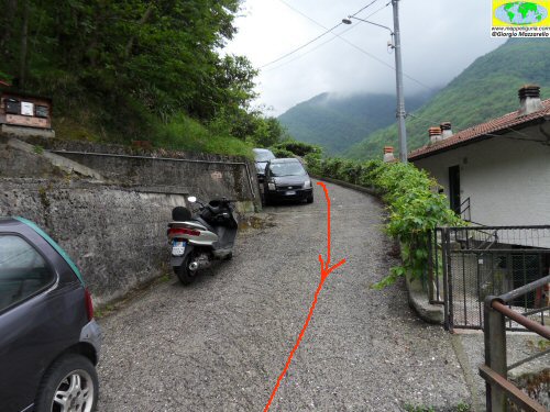
Il percorso parte dalla frazione La Presa di Bargagli (GE).
The route starts from the hamlet La Presa of Bargagli (GE).
COME ARRIVARE / HOW TO REACH STARTING PLACE
![]() Dall’uscita del casello di Ge-Est dell'autostrada A10, prendiamo a sinistra in direzione Torriglia.
Costeggiamo il Torrente Bisagno, usciamo da Genova e, poco dopo raggiungiamo la localita’
"La Presa", dove possiamo lasciare l'auto presso i pochi posti auto presenti vicino alle case.
Dall’uscita del casello di Ge-Est dell'autostrada A10, prendiamo a sinistra in direzione Torriglia.
Costeggiamo il Torrente Bisagno, usciamo da Genova e, poco dopo raggiungiamo la localita’
"La Presa", dove possiamo lasciare l'auto presso i pochi posti auto presenti vicino alle case.
From the exit of Ge-East of the A10 motorway, we take left towards Torriglia. We skirt the creek Bisagno, we leave the town of Genoa and, shortly after we reach the place called "La Presa", where we can leave the car at the few parking spaces available near the houses.
PERIODO / WHEN TO GO
Tutto l'anno.
In inverno e’ possibile incontrare tratti innevati e/o ghiacciati.
All the year.
In winter you can meet traits snowy and / or icy.
DIFFICOLTA' / DIFFICULTIES
Secondo la scala CAI: T-E (Turistica-Escursionistica)
Si tratta di un facile percorso su comodi sentieri sempre evidenti e segnalati,
ma essendo un sentiero lungo un torrente, e' possibile che in alcune stagioni sia
parzialmente infrascato e che siano presenti alcuni rami e piccoli alberi abbattuti sul sentiero.
Questo non preclude la percorribilita’ del percorso ma lo rende a tratti difficoltoso.
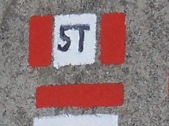
Attenzione ai segnavia, che sono presenti ma a volte risultano coperti dalla vegetazione.
According to CAI classification: T-E (for Toursit - for Normal Hiker).
It is an easy path on comfortable paths always apparent and marked, but being a trail along
a stream, it is possible that in some seasons is partially flooded vegetation and that
there are some branches and small trees cut down on the path. This does not preclude
the practicability of the route but makes it difficult piecewise. Attention to the markings,
which are always present but are sometimes covered by vegetation.
SCHEDA PERCORSO / ROAD-BOOK
LIBRETTO DI 8 PAGINE CON TUTTI I DATI PER EFFETTUARE L'ITINERARIO
BOOKLET OF 8 PAGES WITH INSIDE ALL INFOMATIONS TO MAKE THE ROUTE
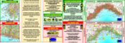
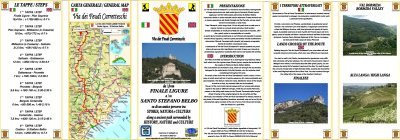
CARTE DI DETTAGLIO / DETAILED MAPS
Tutto il percorso descritto e' contenuto nelle seguenti tavole della collana
mini MAPPE OUTDOOR ACTIVITIES
This route is showed on following
mini MAPPE OUTDOOR ACTIVITIES type maps
Per raggiungere la localita' di partenza e' utile utilizzare la seguente tavola della
collana mini MAPPE CAR
To reach starting places is useful following
mini MAPPE CAR type map
Sei interessato alle CARTE DI DETTAGLIO di questo percorso?
CONTATTAMI
Are you interested about DETAILED MAPS of this route?
WRITE ME
QUALCHE FOTO / SOME PICTURES
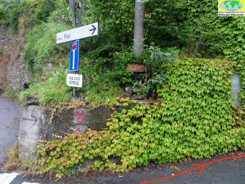
Presso il bivio per Fisi
At junction to Fisi
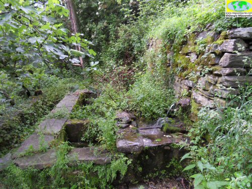
I lavatoi che si incontrano appena si imbocca la scaletta
The sinks that meet immediately after the ladder
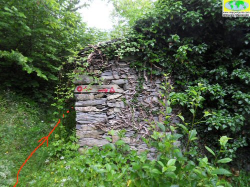
Presso il bivio dove č c'e' la baracca in pietra
At the junction where there is a stone hut
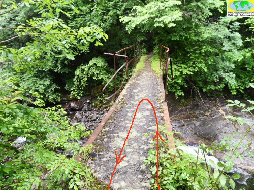
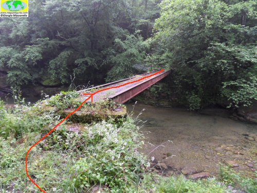
Il ponte sul Lentro che si raggiunge effettuando la deviazione per il lago del Ponte
The bridge over Lentro which is reached by making the detour to "Lago del Ponte"
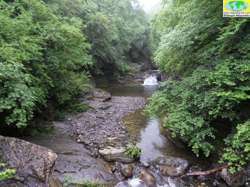
Il "Lago del Ponte"
The Lake of the Bridge
Il ponte sul Lentro che incontriamo poco dopo i ruderi dei mulini
The bridge over Lentro we meet shortly after the ruins of the mills
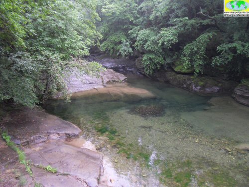
Il "Lago Muin"
Muin Lake
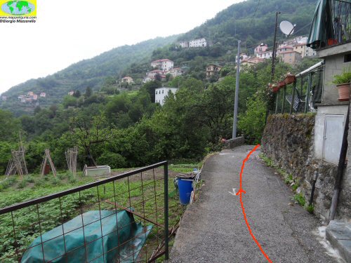
Nei pressi delle case di Viganego
Near the houses of Viganego
Presso Fisi
At Fisi
NOTE /NOTICE
Pur avendo prestato la massima attenzione nella stesura della descrizione del percorso, a causa della mutevolezza del territorio, della variabilita' delle condizioni meteo e di eventuali errori od imprecisioni o giudizi soggettivi indicati nel presente testo, l'autore declina ogni responsabilita' per eventuali incidenti che potrebbero verificarsi. Chi desidera effettuare questo percorso lo fa a proprio rischio e pericolo.
In the description of the route I have done the greatest care, but because of the changing nature of the area, the variability of weather conditions and any errors or inaccuracies or subjective judgments referred to in this text, the author disclaims all responsibility for any accidents that may occur. Those wishing to go this route you do so at your own risk.
Chiunque desiderasse avere maggiori informazioni su questo itinerario, mi
puo' contattare.
Do you want more information about this route?
Please write me
