
![]()
Itinerari TREKKING - Provincia di Genova
TREKKING routes - Genova district
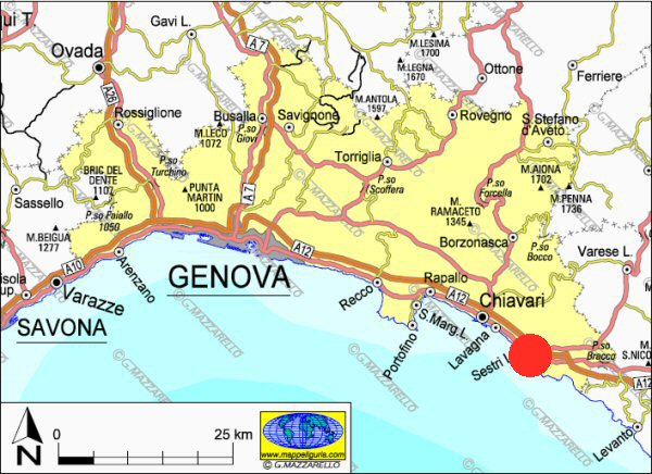
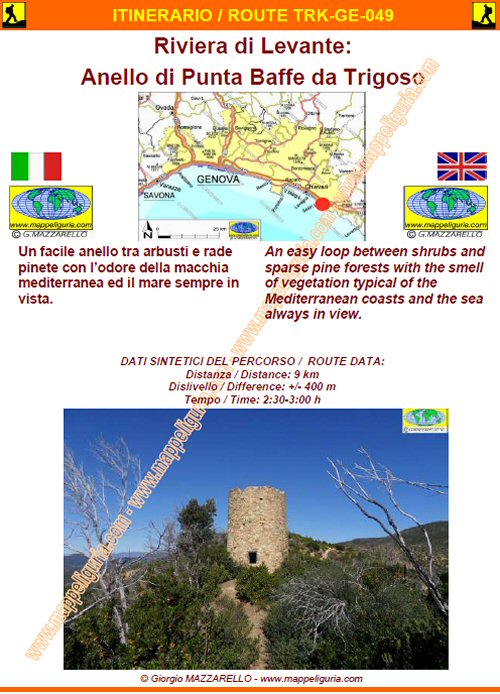
GE-049 - Riviera di Levante: Anello di Punta Baffe da Riva
DATA/DATE
Ottobre 2010
October 2010
NOTE GENERALI / GENERAL NOTES
Un facile anello tra arbusti e rade pinete con l�odore della macchia mediterranea ed il mare sempre in vista.
An easy loop between shrubs and sparse pine forests with the smell of vegetation typical of the Mediterranean coasts and the sea always in view.
DATI SINTETICI DEL PERCORSO / ROUTE DATA
Distanza / Distance: 9 km
Dislivello / Difference: +/-400 m
Tempo / Time: 2:30-3:00 h
LOCALITA' DI PARTENZA / STARTING PLACE
Si parte da Trigoso, frazione di Sestri Levante (GE).
The route starts at Trigoso village of Sestri Levante (GE).
COME ARRIVARE / HOW TO REACH STARTING PLACE
![]() Dall�uscita del casello di Sestri Levante dell'autostrada A12, prendiamo per Riva Trigoso
e poi deviamo a sinistra per imboccare la statale 1 in direzione di La Spezia (direzione levante).
Iniziamo la salita tra le casette di Trigoso e, appena usciti dal centro abitato,
lasciamo l�auto nel piccolo posteggio a DX della strada.
Dall�uscita del casello di Sestri Levante dell'autostrada A12, prendiamo per Riva Trigoso
e poi deviamo a sinistra per imboccare la statale 1 in direzione di La Spezia (direzione levante).
Iniziamo la salita tra le casette di Trigoso e, appena usciti dal centro abitato,
lasciamo l�auto nel piccolo posteggio a DX della strada.
From the exit of Sestri Levante, the A12 motorway, take for Riva Trigoso and then, turn left to enter the SS 1 towards La Spezia (towards the east). We begin the climb among the houses of Trigoso and, just out of the town, leave the car in the small parking lot to the right of the road.
PERIODO / WHEN TO GO
Tutto l�anno.
Da evitare l'estate per il caldo e l'affollamento della localita' di partenza.
This route is open year-round.
To avoid the summer because of the heat and crowds of the town.
DIFFICOLTA' / DIFFICULTIES
Secondo la scala CAI: T-E (Turistica-Escursionistica).
Tutto il percorso si svolge su sterrate e sentieri ben segnati ed evidenti senza alcuna difficolta�
![]()
According to CAI scale: T-E (Turistica-Escursionistica).
The whole route runs on dirt roads and easy paths, always well marked.
SCHEDA PERCORSO / ROAD-BOOK
LIBRETTO DI 10 PAGINE CON TUTTI I DATI PER EFFETTUARE L'ITINERARIO
BOOKLET OF 10 PAGES WITH INSIDE ALL INFOMATIONS TO MAKE THE ROUTE
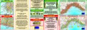
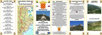
CARTE DI DETTAGLIO / DETAILED MAPS
Tutto il percorso descritto e' contenuto nelle seguenti tavole della collana
mini MAPPE OUTDOOR ACTIVITIES
This route is showed on following
mini MAPPE OUTDOOR ACTIVITIES type maps
Per raggiungere la localita' di partenza e' utile utilizzare la seguente tavola della
collana mini MAPPE CAR
To reach starting places is useful following
mini MAPPE CAR type map
Sei interessato alle CARTE DI DETTAGLIO di questo percorso?
CONTATTAMI
Are you interested about DETAILED MAPS of this route?
WRITE ME
QUALCHE FOTO / SOME PICTURES
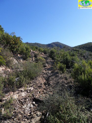
Lungo il sentiero che sale alla sella di quota 312m
Along the trail that climbs to the saddle at 312m
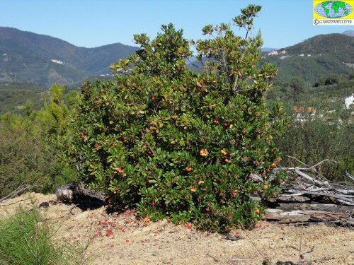
Una bella pianta di corbezzolo
A beautiful strawberry tree
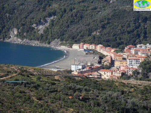
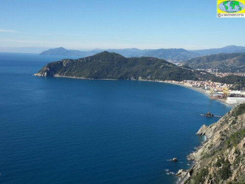
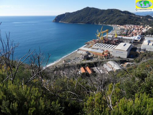
Panorama su Riva Trigoso
Panorama of Riva Trigoso
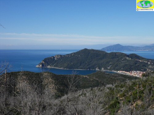
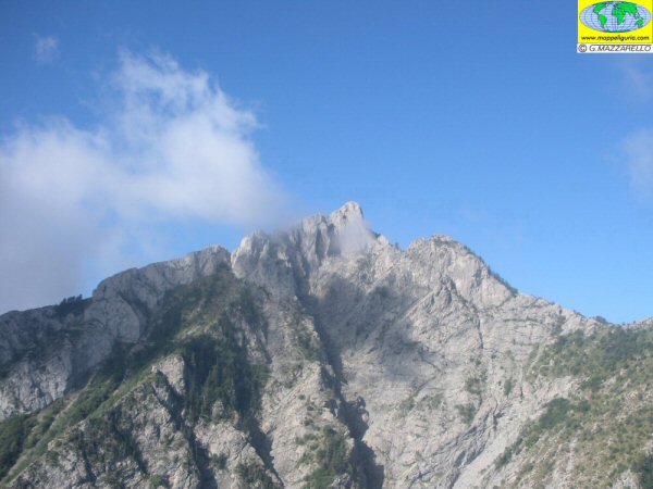
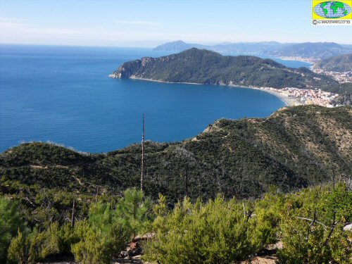
Panorama su Punta Manara
Panorama of Punta Manara
Panorama su Punta Manara
Panorama of Punta Manara
Panorama su Punta Manara
Panorama of Punta Manara
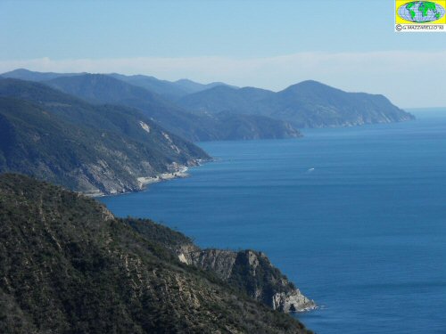
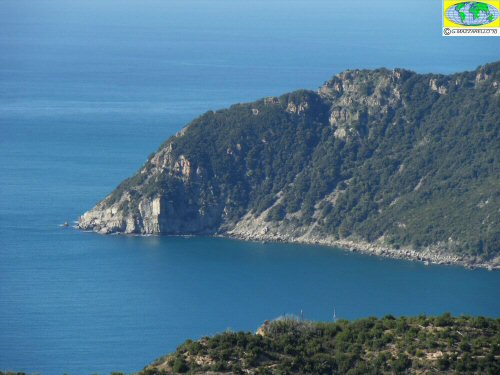
Panorama sulla costa delle Cinque Terre
Panorama of the coast of the Cinque Terre
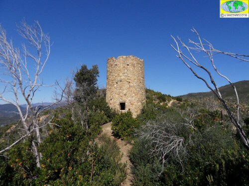
La bella Torretta di Punta Baffe
The beautiful tower of Punta Baffe
Panorama su Punta Manara
Panorama of Punta Manara
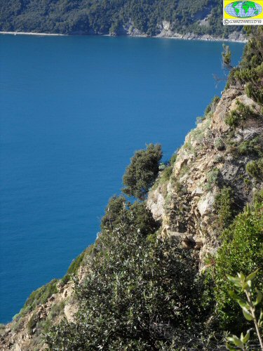
Alberelli appesi sulla scogliera a picco sul mare
Trees hanging on the cliff overlooking the sea
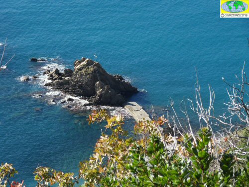
Lo scoglio di Riva
The rock Riva
Panorama sulla baia di Riva
Panorama over the bay of Riva
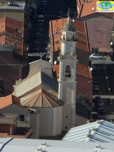
La chiesa di Riva dedicata a S.Pietro
The church of Riva, dedicated to St. Peter
NOTE /NOTICE
Pur avendo prestato la massima attenzione nella stesura della descrizione del percorso, a causa della mutevolezza del territorio, della variabilita' delle condizioni meteo e di eventuali errori od imprecisioni o giudizi soggettivi indicati nel presente testo, l'autore declina ogni responsabilita' per eventuali incidenti che potrebbero verificarsi. Chi desidera effettuare questo percorso lo fa a proprio rischio e pericolo.
In the description of the route I have done the greatest care, but because of the changing nature of the area, the variability of weather conditions and any errors or inaccuracies or subjective judgments referred to in this text, the author disclaims all responsibility for any accidents that may occur. Those wishing to go this route you do so at your own risk.
Chiunque desiderasse avere maggiori informazioni su questo itinerario, mi
puo' contattare.
Do you want more information about this route?
Please write me
