


![]()
Itinerari MTB - Provincia di Genova
MTB routes - Genova district
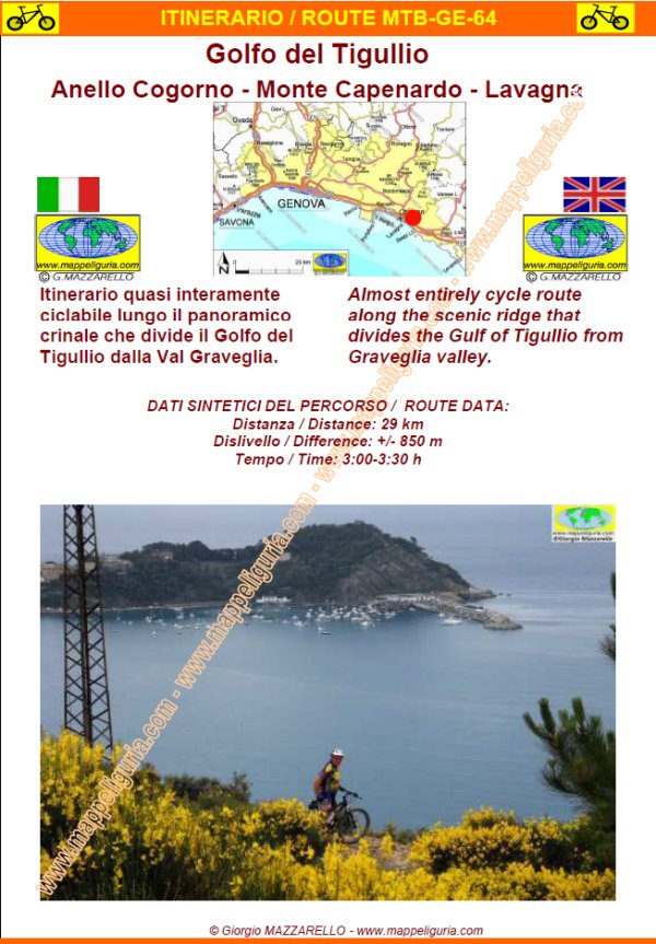
MTB-GE-064
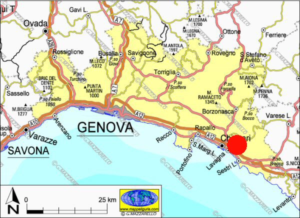
Golfo del Tigullio:
Anello Cogorno - Monte Capenardo - Lavagna
Tigullio gulf:
Loop of Cogorno - Monte Capenardo - Lavagna
DATA/DATE
Maggio 2012
May 2012
NOTE GENERALI / GENERAL NOTES
Itinerario quasi interamente ciclabile lungo il panoramico crinale che divide il Golfo del Tigullio dalla Val Graveglia.
Almost entirely cycle route along the scenic ridge that divides the Gulf of Tigullio from Graveglia valley.
DATI SINTETICI DEL PERCORSO / ROUTE DATA
Distanza / Distance: 29 km
Dislivello / Difference: +/-850 m
Tempo / Time: 3:00-3:30 h
Asfalto /Paved roads: 31%
Ciclabilita' / Cycle: 99%
LOCALITA' DI PARTENZA / STARTING PLACE
Il percorso inizia presso il Ristorante Settembrin, situato dove inizia la strada provinciale della Val Graveglia (comune di Carasco).
The route starts at the Restaurant Settembrin, located where begin the road of Graveglia valley (municipality of Carasco).
COME ARRIVARE / HOW TO REACH STARTING PLACE
Dall'uscita del casello di Lavagna dell�Autostrada A12, prendiamo a destra. Oltrepassiamo il borgo di Cogorno raggiungiamo la rotatoria dove inizia la provinciale della Val Graveglia (posteggio auto a sinistra - e'il posteggio del ristorante ma non ci dovrebbero essere problemi, in alternativa si puo' lasciare l'auto nei posteggi lungo la strada.
From the exit of Lavagna of the A12 motorway, we turn right. We pass the village of Cogorno and reach the roundabout where begin the road of Graveglia valley (car parking on the left - it's the parking lot of the restaurant but there should be no problems, alternatively you can leave your car in parking lots along the way.
PERIODO / WHEN TO GO
Tutto l�anno.
All the year.
DIFFICOLTA' / DIFFICULTIES
Secondo la scala CAI: MC (Medi Ciclisti)
TECNICHE:
Le difficolt� tecniche sono abbastanza limitate. I tratti difficoltosi sono i seguenti:
- circa 200 m di discesa dal Monte Capenardo su terreno sconnesso
- alcuni passaggi tecnici su roccia lungo la discesa dalla Costa Rossa.
IMPEGNO FISICO:
L�impegno fisico � da considerare medio.
Globalmente lunghezza e dislivello non sono elevati ed il dislivello � tutto presente nella prima salita.
According to the CAI classification: MC (Enough trained cyclists)
TECHNICAL:
The technical difficulties are quite limited. The difficult sections are as follows:
- approximately 200 m of descent from Mount Capenardo on rough terrain and rocky
- some technical rock climbs along the descent from the Costa Rossa.
PHYSICAL:
The commitment is to consider medium.
Overall length and height difference are not high and the difference in height is all present in the first climb.
SCHEDA PERCORSO / ROAD-BOOK
LIBRETTO DI 12 PAGINE CON TUTTI I DATI PER EFFETTUARE L'ITINERARIO
BOOKLET OF 12 PAGES WITH INSIDE ALL INFOMATION TO MAKE THE ROUTE
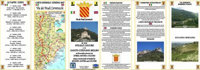
CARTE DI DETTAGLIO / DETAILED MAPS
Tutto il percorso descritto e' contenuto nelle seguenti tavole della collana
mini MAPPE OUTDOOR ACTIVITIES
This route is showed on following
mini MAPPE OUTDOOR ACTIVITIES type maps
Per raggiungere la localita' di partenza e' utile utilizzare la seguente tavola della
collana mini MAPPE CAR
To reach starting places is useful following
mini MAPPE CAR type map
Sei interessato alle CARTE DI DETTAGLIO di questo percorso?
CONTATTAMI
Are you interested about DETAILED MAPS of this route?
WRITE ME
QUALCHE FOTO / SOME PICTURES
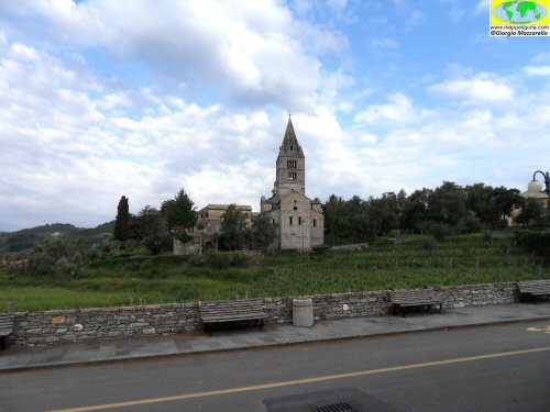
La Basilica dei Fieschi che incontriamo salendo verso Breccanecca
The Basilica of the Fieschi we meet up towards Breccanecca
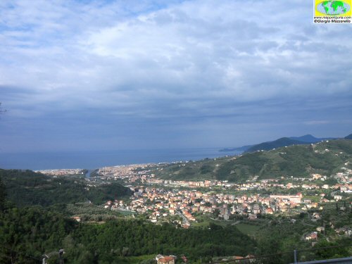
Panorama sulla pianura del Torrente Entella
Panorama over the plains of the River Entella
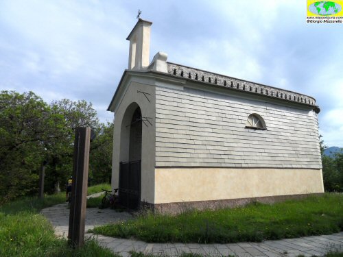
La bella cappella di S.Giacomo
The beautiful chapel of St. James
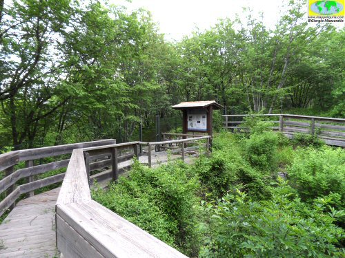
Nei pressi della ex Cava di ardesia del Monte S.Giacomo ora trasformata in museo.
Near the former slate quarry of Mount St. James now a museum.
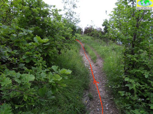
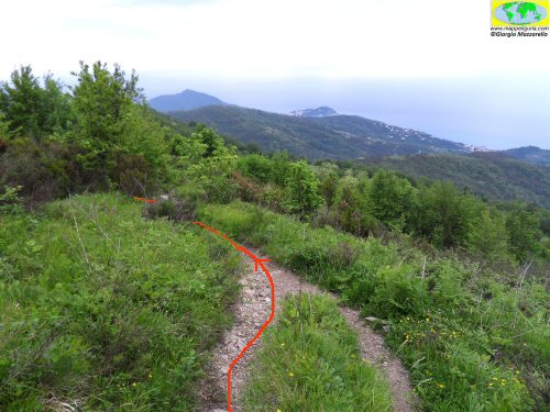
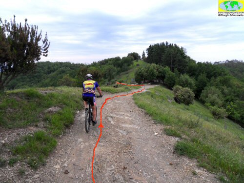
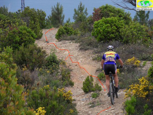
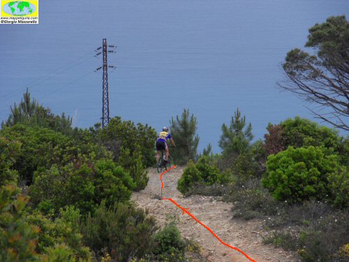
Lungo il sentiero
Along the footh-path
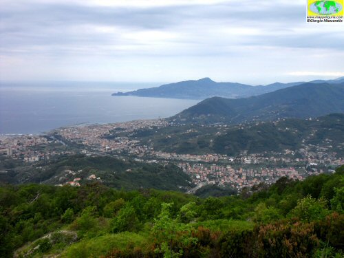
Panorama sulla pianura del Torrente Entella
Panorama over the plains of the River Entella
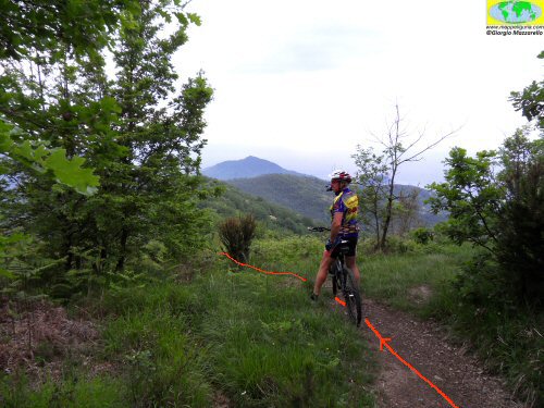
Salendo verso il Monte Le Rocchette
Going up to Mount Le Rocchette
Sulla cima del Monte Capenardo
On the summit of Mount Capenardo
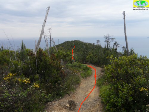
Lungo il sentiero
Along the footh-path
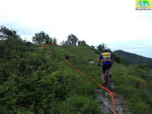
Nei pressi dell'area prativa del Monte Costello
In the grassy area near the Mount Costello
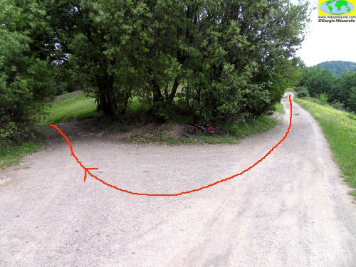
Il bivio del Monte Costello
Mount Costello junction
Scendendo lungo la Costa Rossa
Going down the Costa Rossa
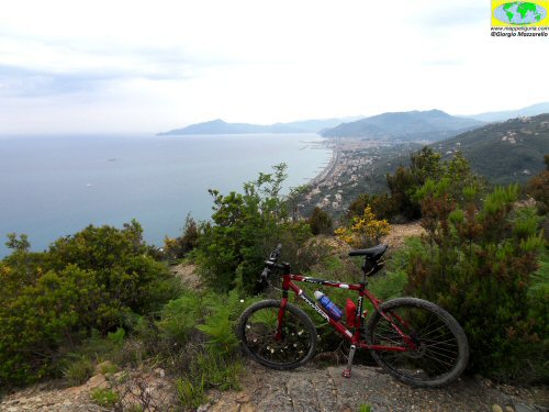
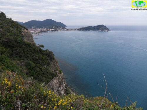
Panorama su Sestri Levante
Panorama of Sestri Levante
Scendendo lungo la Costa Rossa
Going down the Costa Rossa
Scendendo lungo la Costa Rossa
Going down the Costa Rossa
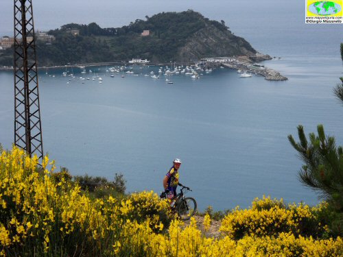
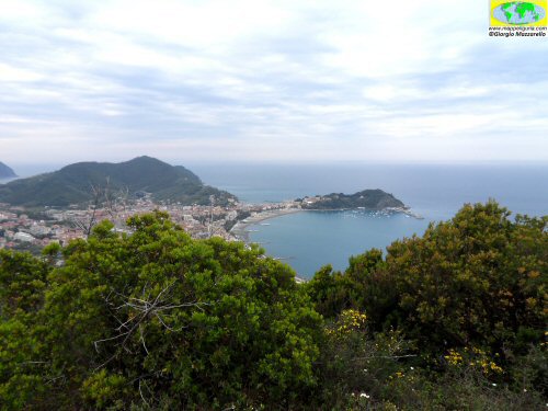
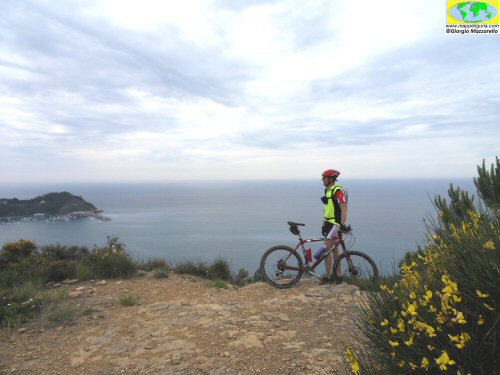
Panorama sul Golfo del Tigullio
Panorama of the Gulf of Tigullio
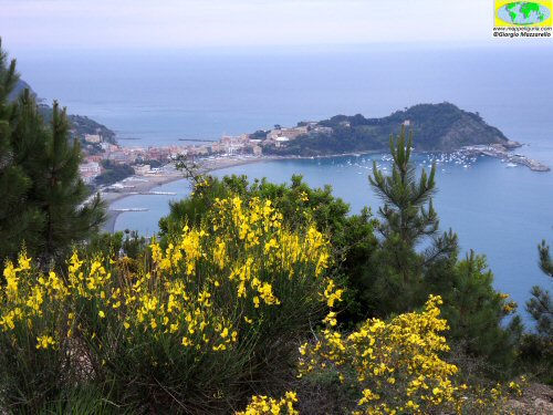
Quando il giallo delle ginestre, si sposa con l'azzurro del mare
When the yellow broom, is combined with the blue sea
Quando il giallo delle ginestre, si sposa con l'azzurro del mare
When the yellow broom, is combined with the blue sea
Punto panoramico verso Sestri Levante
Viewpoint towards Sestri Levante
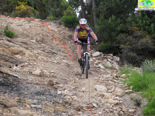
Un breve tratto su roccia lungo la Costa Rossa
A short stretch of rock along the Costa Rossa
Vista di Sestri Levande dalle Rocche di S.Anna
Sestri Levante view from S.Anna
NOTE /NOTICE
La percorribilita' in MTB di qualsiasi itinerario e' molto soggettiva e dipende dall'allenamento, dalle capacita' tecniche individuali e dalle condizioni del terreno. In linea generale e' necessario comunque un discreto allenamento ed un minimo di capacita' tecniche. Chi pratica MTB lo fa a suo rischio e pericolo. Nei tratti impegnativi o pericolosi si consiglia comunque di non rischiare e scendere dalla bici. Lungo i sentieri, le strade sterrate ed in generale lungo tutti i percorsi, si raccomanda di dare assoluta precedenza agli escursionisti ed a tutti i pedoni. L'autore declina ogni responsabilita' per eventuali incidenti che potrebbero verificarsi.
The practicability of any MTB route is very subjective and depends on training, individual technical skill and on ground conditions. In general, however, a reasonable workout and a minimum of technical skills is required. Those who practice MTB do it on own risk. Along challenging or dangerous path it is better not to risk it and proceed on foot with hand bike. Along all foot-paths, trails and dirt roads, and in general along all paths, it is recommended to give absolute priority to all hikers and pedestrians. The author disclaims all responsibility for any accidents that may occur.
Chiunque desiderasse avere maggiori informazioni su questo itinerario, mi
puo' contattare.
Do you want more information about this route?
Please write me
